


Summary (English)
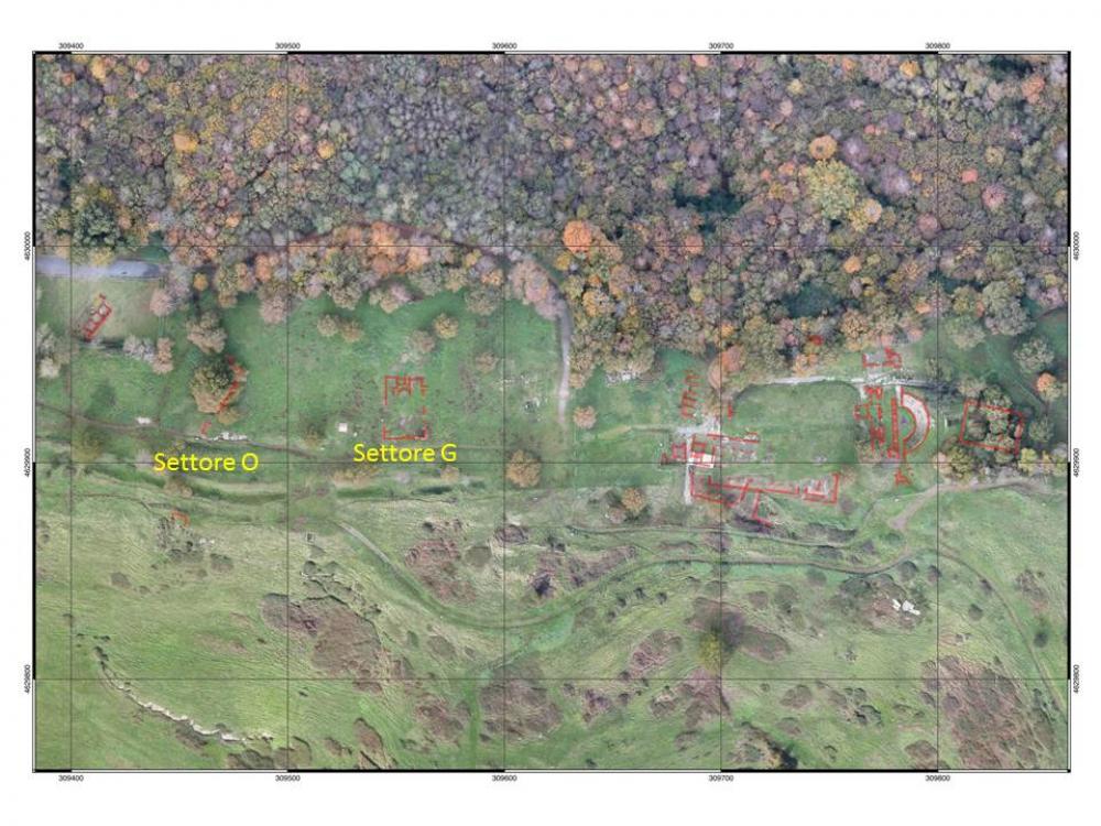
The 21st campaign of excavations at Tusculum undertaken by EEHAR-CSIC saw the opening of two new areas in the western part of the city (O1000 and O2000), a trench in the baths area (sector G) (Fig. 1), a surface survey in the surrounding territory and a geophysical survey on the plateau to the west of the forum.
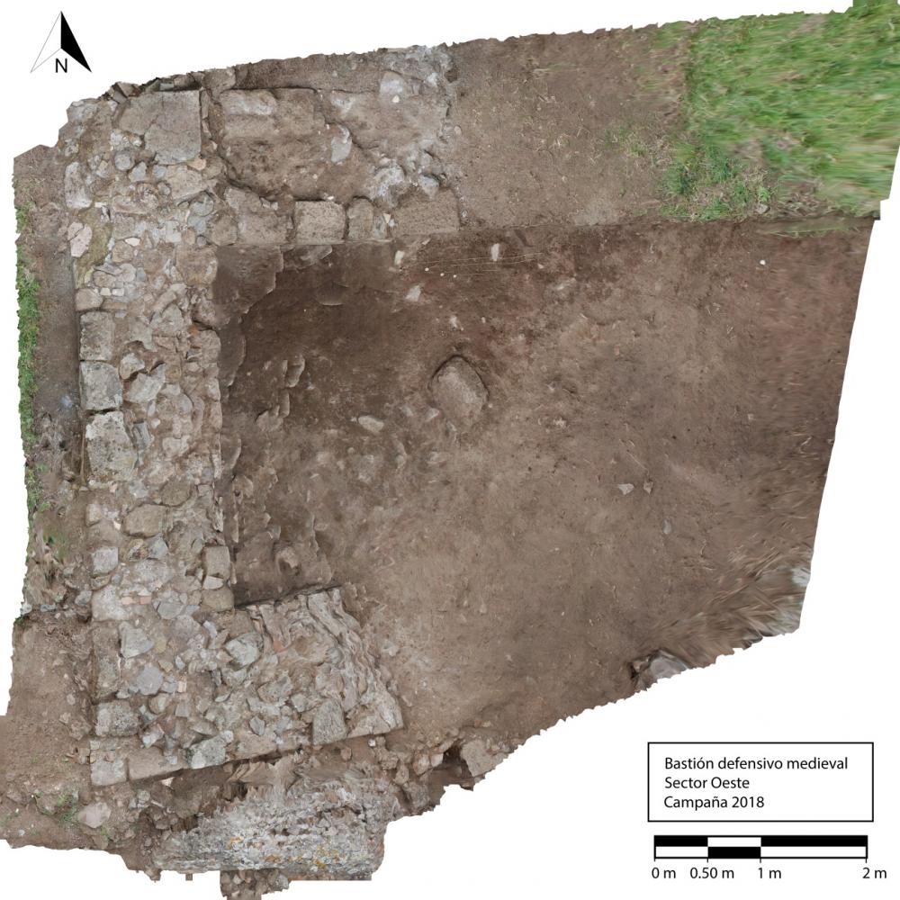
The excavations in sector O aimed to define the city’s perimeter and investigate the medieval defences.In sector O1000, on the south-western side of the plateau, the remains of a Roman cistern were identified, which was reused for funerary purposes in the medieval period. Immediately north (sector O2000) a section of the medieval town’s west wall, over 30 m long, was uncovered. It was built with a double facing and cement core, and incorporated, partially reusing, the remains of an earlier Roman structure, including an opus mixtum wall of Hadrianic date, and patches of opus signinum floor. The construction of an imposing bastion in tufa opus quadratum also dates to the mediaeval phase. The bastion obliterated the ancient basalt road leading into the town (Fig. 2).
The sondage opened in sector G aimed to investigate the westernmost of the 12 medieval sepulchral galleries, situated along the façade of the church built on top of the remains of the Roman baths identified in 2015. Inside the ossuary, 2.90 m deep, three distinct depositional phases dating to the 11th-12th centuries were identified. The ossuary contained a total of 27 individuals.
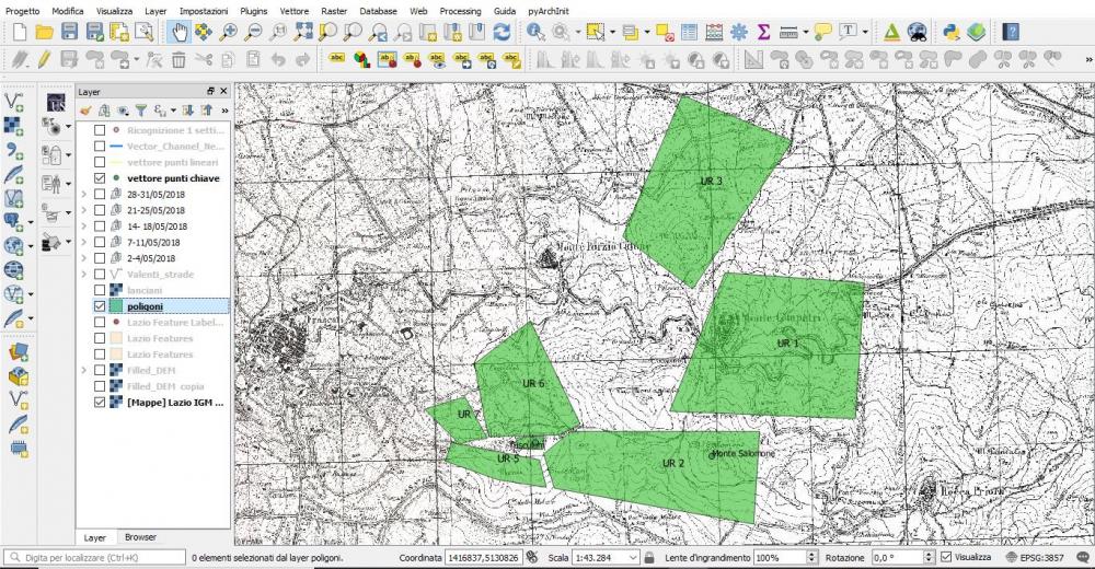
The surface survey investigated the position of Tusculum in relation to the surrounding territory, in particular along the north (UR 6) and south-eastern (UR 2) sides, in order to reconstruct the development of the principal and secondary road network providing access to the town (Fig. 3).
Director
- Antonio Pizzo (Escuela Española de Historia y Arqueología en Roma-CSIC)
- Valeria Beolchini (Escuela Española de Historia y Arqueología en Roma-CSIC)
Team
- Antonella Frigerio
- Daniele Federico Maras-Direttore archeologo coordinatore Soprintendenza Archeologia, Belle Arti e Paesaggio per l’area metropolitana di Roma, la provincia di Viterbo e l’Etruria Meridionale
- Valeria Beolchini- Escuela Española de Historia y Arqueología en Roma-CSIC
- Salvatore Piro- ITABC-CNR
- Gianluca Mandatori
- Jacopo Russo
- Vincenzo Tallura- La Sapienza, Univ. di Roma
- Marina Marcosignori-Univ. Bologna
- Marta Pérez Polo- Univ. Zaragoza
- Álvaro Corrales Álvarez (EEHAR-CSIC)
- Christian Barbisan-La Sapienza, Univ. di Roma
- Flavia Ricci- La Sapienza, Univ. di Roma
- Massimo Zanfini
Research Body
- Escuela Española de Historia y Arqueología en Roma-CSIC
Funding Body
- Comunità Montana del Lazio “Castelli Romani e Prenestini”
- Consejo Superior de Investigaciones Científicas; Ministerio de Educación, Cultura y Deporte-Instituto del Patrimonio Cultural de España XI
![[PDF]](download.php?file=7726.jpg "Download")
![[PDF]](download.php?file=7727.jpg "Download")
![[PDF]](download.php?file=7728.jpg "Download")