Summary (English)
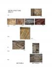
This was the 17th campaign of excavation on the site of Poggio Imperiale at Poggiobonsi (SI) dating to between the early 6th and the 15th centuries. This season, the primary aim was to investigate the late medieval levels (12th-14th centuries) and check for the presence of early medieval deposits. An area of c. 20 × 20 m was opened immediately east of that excavated last year in order to further investigate the urban layout of Podium Bonizi. The latest levels date to 1313, the year in which Arrigo VII, undertaking his Iter Italicum_, reached Poggibonsi and founded, on the ruins of Poggio Bonizio, destroyed by the Florentines in 1270, a new town called Monte Imperiale. Although this project was never completed due to the emperor’s death five months after the foundation of Poggio Imperiale, the construction work was already in an advanced state. This aspect was further confirmed during this season by the identification of another building (ED11). The layers mentioned above covered the stratigraphy relating to a large terraced house that was part of the castle of Podium Bonizi and in this case, it was possible to identify its various occupation phases. Originally in 1155, the year of Poggio Bonizi’s foundation, the building (ED106) was a large terraced house with a ground floor with a travertine paving and structured in two aisles divided by a series of pillars and half-pillars, which supported the upper floors. No collapsed material was found for this building, but based on the size of the walls and the pillars it may be suggested that the building had two more floors.
This first phase concluded at the end of the 12th century, when a violent earthquake, probably the same as the one attested at Arezzo in 1192, destroyed the castle of Podium Bonizi. Following this destruciton, the reconstruction changed the building’s typology. The buildings were rebuilt on a smaller scale, making use of earth walls, which either made use of foundations of roughly-worked stone blocks or rested on the perimeter walls of the earlier terraced house whose walls lost their function as supporting structures. In our case, the terraced house was substituted by two buildings: a small rectangular structure, divided in two, (ED108) was built in the northern part while the central part was occupied by a building (ED107) formed by a ground floor and a mezzanine floor that functioned as living quarters. Both structures functioned as blacksmith’s workshops, in fact, the remains of a number of forges were found in both. The identification of these workshops constitutes important information as, considering that the neighbouring buildings had the same function, it shows this area of the settlement formed a large and structured smith’s quarter (two workshops situated immediately east of those investigated this year and one situated on the other side of the road on which the they stood). Another building (ED109) was identified immediately south of the terraced house, which was used for storage as attested by the large amount of animal bones and pottery found inside it. Subsequently, the early medieval levels were investigated. The evidence led to the identification of a succession of three structures, which have been given a preliminary chronology based on construction technique while awaiting the finds study. There was a boat-shaped hut (C101) built using the sleeping -beam technique, but only one side was preserved as part was cut by the foundations of the terraced house. A rectangular hut (C103) identified in the southern part of the metalworking area was earlier in date and a forge hearth and a portion of earth wall still in situ were preserved. The latter obliterated a semi-sunken hut (C102) of sub-circular plan of which the entrance/slide was also found; the construction technique and stratigraphic sequence date the hut to the Lombard period. The 2019 campaign will aim to continue the investigations in the southern part of the site in order to gain a full understanding of the archaeological deposit on this side of the hill.
- Devid Savegnago – Università degli Studi di Siena
Director
- Marco Valenti - Università degli Studi di Siena
Team
- Carla Palmas – Università degli Studi di Siena
- Federica Foresi – Università degli Studi di Siena
- Alessandra Nardini - Università degli Studi di Siena
- Cristina Menghini –Università degli Studi di Siena
- Devid Savegnago – Università degli Studi di Siena
Research Body
- Dipartimento di Scienze Storiche e dei Beni Culturali, Università degli Studi di Siena
Funding Body
- Comune di Poggibonsi


![Download [PDF]](/excavation/skins/fasti/images/results/download_sml.png)