


Summary (English)
The 2013 campaign concentrated on the eastern sector of the fortress, to date unexplored, with the aim of investigating the relationship between the nuraghe, its presumed defensive wall, and the foundation of the Iron Age II fort.
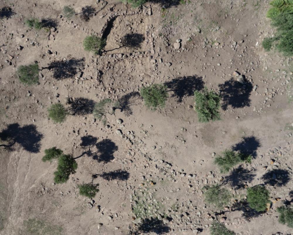
Eastern fortifications
Outside the nuragic enclosure wall of the pre-existing village (USM 530), underneath a sparse clay deposit (US 1001) originating from the collapse of the mud brick walls, an oblique scarp of packed earth and small stone fragments (US 1025) was seen to abut the enclosure wall. To the east of the earthworks a number of finds completed the picture of the fortifications: the east perimeter of the earthworks had a toothed profile; there was a small stairway (USM 611, quadrants 102-103H) built of a single course of rough-hewn stone blocks adjacent to and bonded with the perimeter.At the foot of the steps the terrain was formed into two stepped landings (USM 612) contained by a facing of stone courses. A curved projecting stretch of the enclosure wall (USM610), about 5 m in length, was identified that could have been a curved tower, later filled during the construction of the scarp.
Block K
A new block (K) was identified inside the fortifications, separated from the enclosure wall by a ramped passageway about two metres wide. Only the first layer of collapse was removed in one of the rooms, however the block appears to be made up of groups of rooms built in different phases.A first block, on a NE-SW alignment, was formed by two rooms (K1 and K2), with slightly curved walls and sub-rectangular and trapezoidal plans. The entrances were diametrically opposed to one another, one in the east corner, and the other in the west corner. A second block of rooms, attested by the wall crests and in the surfaces of the underlying collapses, developed to the south of and seemingly abutted the first. This second block was on a N-S alignment, parallel with enclosure wall 530.
The following hypothetical building phases have been reconstructed based on the physical and stratigraphic relationships between the excavated deposits:
Phase I. (Iron Age I, pre 7th century B.C.) Phase of the enclosure wall surrounding the nuragic village (USM 530); rooms K1 and K2 in block K also probably date to this phase or a phase predating the foundation of the fort.
Phase II (Phase I of the fort, c. 625-575 B.C.) The creation of the earthworks, the construction of the toothed eastern perimeter including the steps and terracing, date to the fort’s first phase. In the same phase, the scarp south of the earthworks was built that slopes down to a second, curved enclosure wall (USM 1022), whose date remains to be established. The part of block K that develops to the south might date to the fort’s first phase.
- Carla Perra - Museo Archeologico Villa Sulcis, Comune di Carbonia
Director
Team
- Stefano Santocchini - Università di Bologna
- Valentina Ligas - Università di Cagliari
- Andrea Galizia - Società ATI IFRAS s.p.a.
- Mafalda Mascia, Emanuele Mei, Maristella Cera
- Vittorio Cera, Roberto Cubeddu, Antonio Loi, Rosanna Masala, Maurizio Milia, Roberto Zuddas, Mariuccia Monni
Research Body
- Museo Archeologico Villa Sulcis
Funding Body
- ATI Ifras s.c. a r.l
- Comune di Carbonia
![[PDF]](download.php?file=1385.jpg "Download")