


Summary (English)
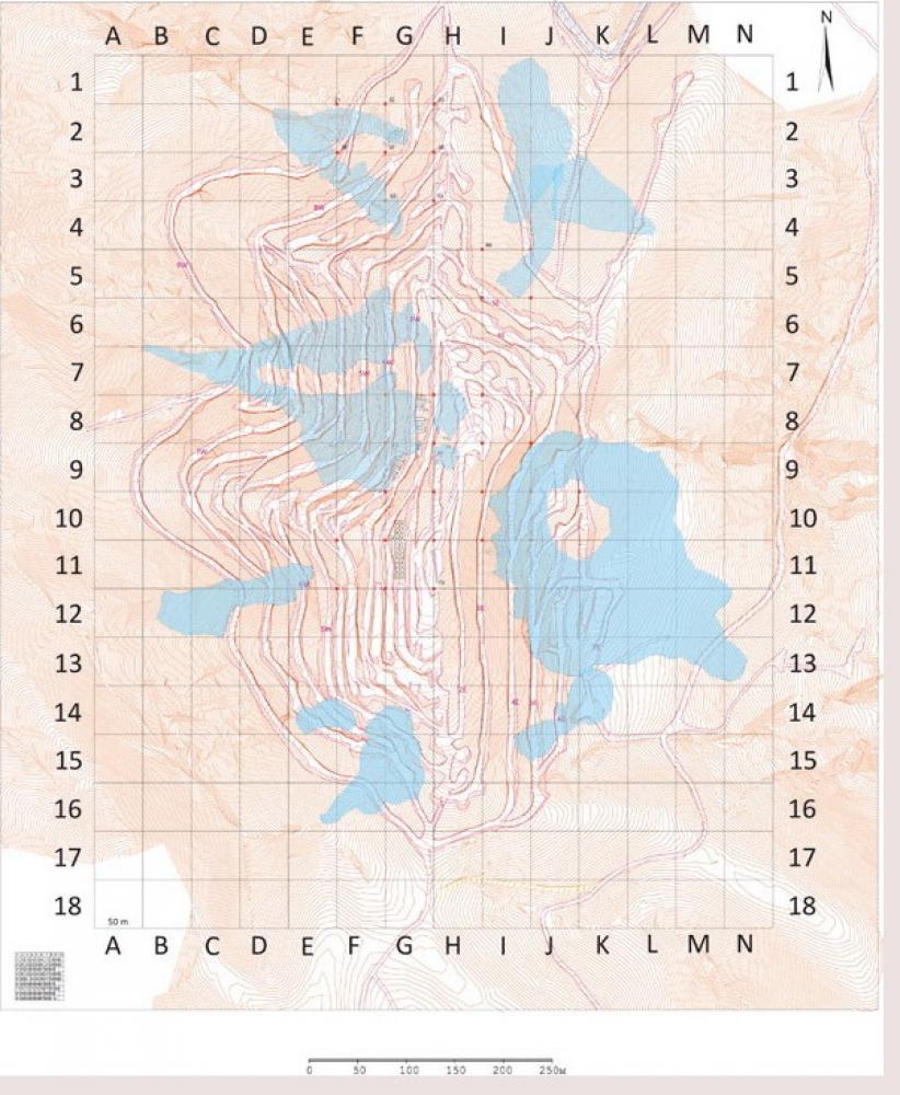
EXPLORATIONS ON ADA TEPE HILL (Hristo Popov – popovhristo@yahoo.co.uk) Mapping of the gold mines was done. Geophysical explorations were carried out on the top of the hill. Archaeological excavations were carried in Sectors E-3, F-2, F-4, G-2, G-8, G-9, G-10, G-11, H-8, H-9, I-10, I-11, so far. The mine tailings were the most common structures covering a total area of 120,000 sq. m. The total area of the mine tailings, the wok platforms, the open mines, the underground galleries and the occupation areas was over 175,000 sq. m. The strata were 0.40 – 1.50 m thick. Traces from open mines and work platforms situated nearby were documented in the area of the upper western slopes (Sectors G-8 and G-9). Fragmentary stone and flint tools and sherds were found on the work platforms. Late Bronze Age material was discovered in most areas of the mines, in all sectors on the western, eastern and northern slopes. Early Iron Age material was discovered only in the central and part of the eastern and western sectors. Debris from several buildings was documented on the top of the hill, to the west and to the north of the sanctuary which was explored in 2001 – 2006.
- Hristo Popov - Archaeological Institute with Museum
Director
Team
Research Body
- Archaeological Institute with Museum
![[PDF]](download.php?file=1866.jpg "Download")
![[PDF]](download.php?file=1867.jpg "Download")
![[PDF]](download.php?file=1868.jpg "Download")