


Summary (English)
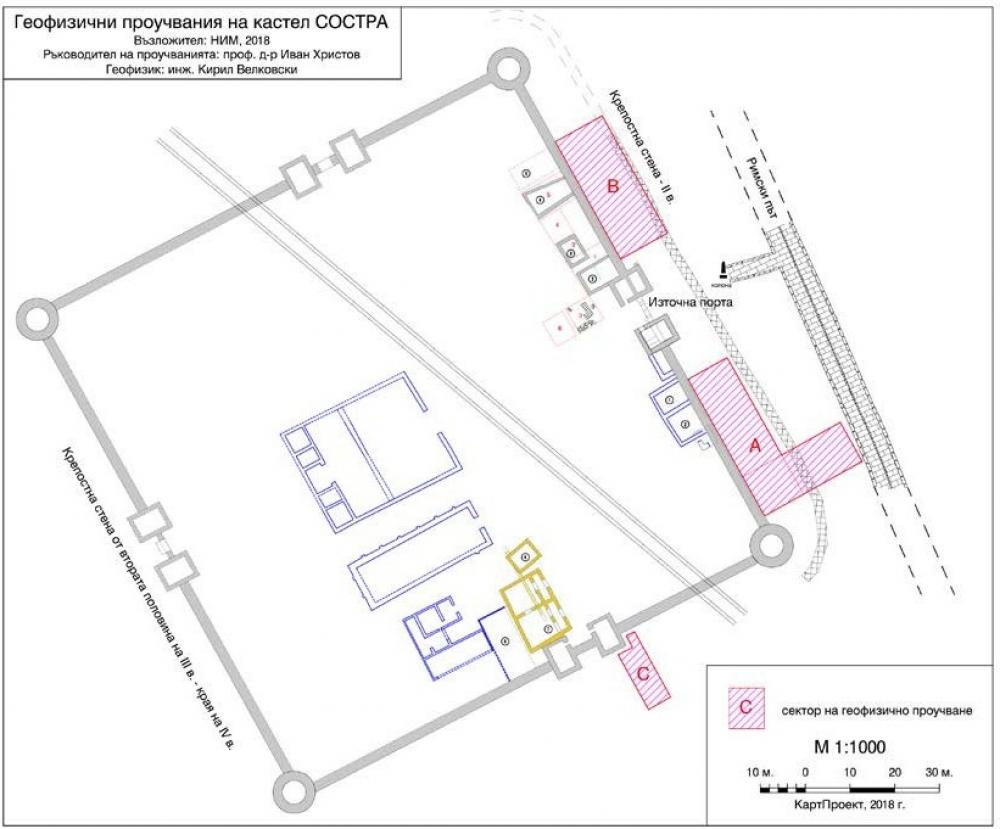
SOSTRA (Ivan Hristov – ivchristov70@abv.bg) The earliest fortification wall of Sostra was probably built by soldiers of Cohors II Matiaca during the second half of the 2nd century AD. The eastern fortification wall was 1.90 m wide and c. 130 m long. Geophysical surveys were carried out with Lidar for locating any fortification towers and other structures. Sector A covered an area of 550 sq. m, situated between the southeastern circular tower of the castellum of the 3rd century AD and the southern tower flanking the main eastern fortification gate. To the east, the sector reached the earliest fortification wall of the military camp. Sector B covered an area of 375 sq. m, situated between the northern tower flanking the eastern fortification gate of the castellum and the northeastern circular tower. To the east, the sector reached the earliest fortification wall of the military camp. Sector C covered an area 5.60 m wide and 15 m long, situated to the south of the eastern tower flanking the main southern gate of the castellum. The surveys documented the extension of the earliest fortification wall to the northeast of the northern tower flanking the eastern fortification gate of the castellum and to the south of the southern fortification gate of the castellum.
- Ivan Hristov - National Museum of History
Director
- Ivan Hristov - National Museum of History
Team
Research Body
- National Museum of History
![[PDF]](download.php?file=12301.jpg "Download")

![[PDF]](download.php?file=12302.jpg "Download")