


Summary (English)
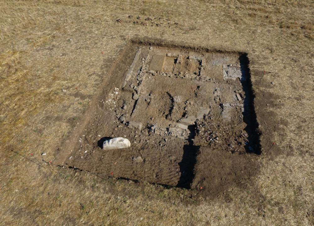
The excavations undertaken in the central sector of the town, in correspondence with a crossroads identified on an aerial photograph, exposed the southern part of so-called Building B, already partially identified in 2016. The building is situated in the north-eastern corner of the crossroads between the E-W basalt road (already identified south of the baths and in the forum) and the N-S via glareata visible in the aerial photograph and uncovered in 2016. Building B mirrors the position of Building A (excavated 2015-2016); both face onto the E-W basalt road, their facades aligned. A section of kerb relating to the N-S via glareata was uncovered to the west of Building B. To the east, below a layer of painted plaster fragments were the remains of a room (USM 247, 260) of Imperial date with a semicircular wall (USM 254). This context was cut by later activities, probably relating to several burials.
Building B, orientated 14° west consistent with the urban layout, is c. 6 m wide and visible for a maximum of 8.60 m. The west perimeter wall (USM 185) was built in opus incertum, with large stone chippings (width 0.45 m; max, visible length 6.10 m). The east wall (USM 272; width 0.45 m), preserved at foundation level only for a short stretch (1.48 m) in correspondence with room 3, was built of cement and limestone and travertine fragments. A number of large ditches (UUSS -221, -223, -278), perhaps interpretable as modern drainage, created in correspondence with the south facade of Building B, had compromised the preservation of the facade wall (USM 275), of the south-west and south-east corners of the building and part of the occupation surfaces.
Inside the building, in the south-east corner, a patch of opus signinum floor was preserved (US 211) in association with a small tile-built channel (US 270), cut by ditches to the west and east (UUSS -223, -278). The channel sloped steeply down to the east suggesting the presence of water inside room 3. However, none of the evidence suggested the function of Building B, or more specifically, room 3.
Originally, this part of Building B must have been formed by one large room delimited to the north by the cement wall USM 186 (0.43 m wide). Later, the construction of a wall (USM 202) on an east-west alignment divided the room in two: to the south room 3; to the north, rooms 1 and 2 were created between walls 202 and 186, served by a corridor to the east and defined by walls 204 and 246 (on a north-south alignment).
The preliminary analysis of the pottery dates the building to between the 1st century B.C. and the Imperial period; a 5th-6th century coin found in the abandonment layers attests occupation in this period.
- Adriana Valchera - Università del Salento, Dipartimento di Beni Culturali, Laboratorio di Topografia Antica e Fotogrammetria (LabTAF)
- Antonio Leopardi - Università del Salento
Director
Team
Research Body
- Università del Salento, Dipartimento di Beni Culturali, Laboratorio di Topografia Antica e Fotogrammetria (LabTAF)
Funding Body
- Università del Salento, Dipartimento di Beni Culturali
![[PDF]](download.php?file=6320.jpg "Download")