


Summary (English)
The eastern quarter of the city, separated from the western one by the Frittolo gorge, is characterised in its upper part by steep rocky slopes, while the lower part is formed by large flat terraces covered by an extensive olive grove. To date, only the western part of the eastern quarter has been investigated, while the eastern and south-eastern areas have remained almost completely outside the study.
Therefore, one of the main objectives of this campaign was the general study of the urban layout of the quarter and its function. Research started with the road network, identified by F. Krinzinger in the western zone during the 1980s, aligned in a north-north-east/south-south-west direction (direction 6 in the overall urban system of Velia). In order to examine whether and how far this system extended towards the east, geophysical surveys (magnetometer and georadar) were undertaken across a total area of 7.7 hectares. The surveys confirmed that the road network on alignment 6 extended to the south and east only as far as this area where the inlet of the so-called Vignale gorge is situated. On the contrary, the great south-east terrace was laid out on the same alignment as the fortified curtain wall delimiting the area of the city towards the east (new direction 7). In sector QE 4000 it was possible to define the measurements of an Insula (108.90 × 37.42 m). The showiest building was situated in QE 3000: a monumental porticoed complex with a great open courtyard measuring at least 82.86 × 45.61 m, probably a public building.
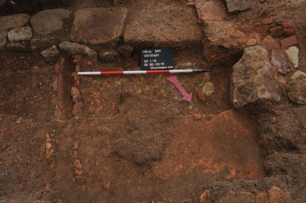
Traces of small kilns, very similar to those identified in trench 1/15 and therefore probably to be interpreted as iron furnaces, were found in various parts of zones QE 2000 and QE 3000. Residential areas and several larger and pyriform kilns, probably for brick and tile, were identified in zone QE 4000 and in particular QE 5000.
The excavations in the southern part of zone QE 2000 led to the discovery of a furnace (FQE 2013) in which iron had been worked. This furnace can probably be dated to the late Republican period and was razed almost to the bottom when, in the mid imperial period, wall FQE 2012 was built. This was on an east-west alignment and can probably be interpreted as the edge of the presumed plateia QE-B/C. In all cases, the buildings in this phase followed direction 6, typical of the western zone of the Vignale QE 1000.
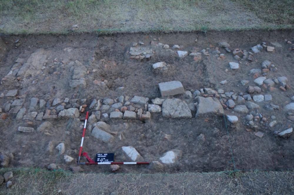
The situation became clearer in the late antique period when wall FQE 2012 was replaced by wall FQE 2011 which ran immediately south of the mid imperial wall. To the south, this wall was associated with a road that had a simple paved surface and a lateral drainage channel belonging to the same context. Surprisingly, the excavations therefore confirmed that the late antique settlement, documented in the lower city of Velia by the excavations of the last decade, also extended into the eastern part of the Eastern Quarter.
- Verena Gassner - Università di Vienna, Istituto di Archeologia Classica
Director
Team
- Gert Augustin
- Torsten Riese - Posselt & Zickgraf, Marburg
- Uwe Stephan - Posselt & Zickgraf, Marburg
Research Body
- Università di Vienna - Istituto di Archeologia Classica
Funding Body
- Progetto del FWF (P 28 156-G025) “Urbanistic studies in the eastern quarter of Velia”
- Università di Vienna - Istituto di Archeologia Classica
![[PDF]](download.php?file=3167.jpg "Download")
![[PDF]](download.php?file=3168.jpg "Download")