


Summary (English)
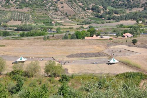
The second excavation campaign provided useful evidence for an evaluation of the archaeological interest of the areas today identified by the toponyms San Vincenzo Ferrer and Bidda Noa, where the research was concentrated with the aim of gaining a better picture of the site’s chronology, stratigraphy, and topography.The excavations provided new evidence relating to the chronology of the abandoned medieval and post medieval village of Villanova Montesanto (15th – 18th century).
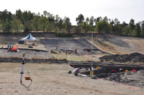
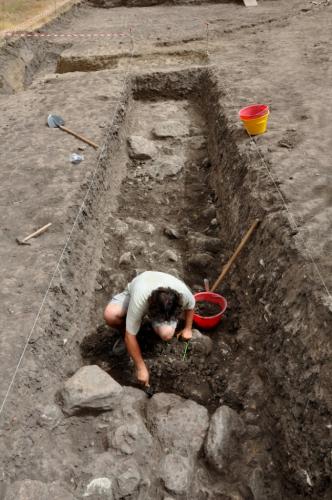
Various interventions in area 200 produced an articulated sequence of dumped stones and tiles, paleo-surfaces and sediments rich in finds relating to village life, dating to between the 15th and 18th centuries.
Area 200 is situated on the edge of the village, the presence of rubbish dumps suggesting that trench 3 and sectors 3 and 4 are close to the actual residential area.In area 300, the excavation of a trench in the drainage channel identified in the lowest part of the site was completed. At the bottom was a loose foundation of stones perhaps relating to the channel’s construction. A fragment of Savona polychrome graffito pottery, dating to the second half of the 15th century, was found among the stones.
The 2012 campaign also provided important topographic and stratigraphic data regarding the site’s nuragic phase. Overall, the evidence from this season suggests that the nuragic settlement occupied an extensive area, calculated to cover several thousands of square metres. It was obliterated by colluvial material, which covered the razed structures that were probably heavily robbed.
The clearest evidence was uncovered in the two sectors investigated in area 100.
In sector 1, part of a structure, probably a hut was identified. The threshold was exposed, in front of which an extensive area had been created using stones for drainage and sediments containing a substantial amount of materials dating to the early Iron Age.In sector 2, an interesting proto-historic structure emerged, characterised by a “seduta”, obliterated by a thick layer of clay hillwash. Three phases were attributed to the Nuragic phase, dated by interesting diagnostic materials.
A trench about 15 m long was opened in area 300. Traces of collapsed terraced structures were identified, suggesting the site was terraced during the nuragic period. In sector 3, the summit of area 300, traces of containing structures towards the valley and an accumulation of ash, containing faunal remains and pottery, were exposed. These structures confirmed the considerable size of the buried nuragic settlement and the transformations its construction must have made to the landscape.
- Marco Milanese - Università degli Studi di Pisa, Dipartimento di Scienze Archeologiche
Director
Team
- Annarita Becciu
- Antonella Bonetto
- Antonella Deias
- Antonella Fois
- Manuela Simbula
- Martina Zipoli
- Luisanna Usai - Soprintendenza per i Beni archeologici di Sassari e Nuoro
- Alessandra Deiana
- Emanuela Sias
- Gianluigi Marras
- Maria Cherchi
- Maria Chiara Deriu
- Matteo Pipia
- Paola Derudas
Research Body
- Università degli Studi di Sassari, Dipartimento di Scienze Umanistiche e dell’Antichità
Funding Body
- Comune di Siligo
![[PDF]](download.php?file=293.jpg "Download")
![[PDF]](download.php?file=294.jpg "Download")
![[PDF]](download.php?file=295.jpg "Download")