


Summary (English)
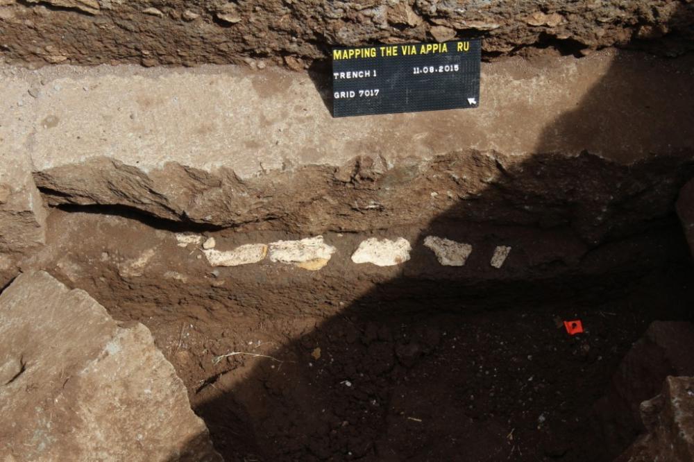
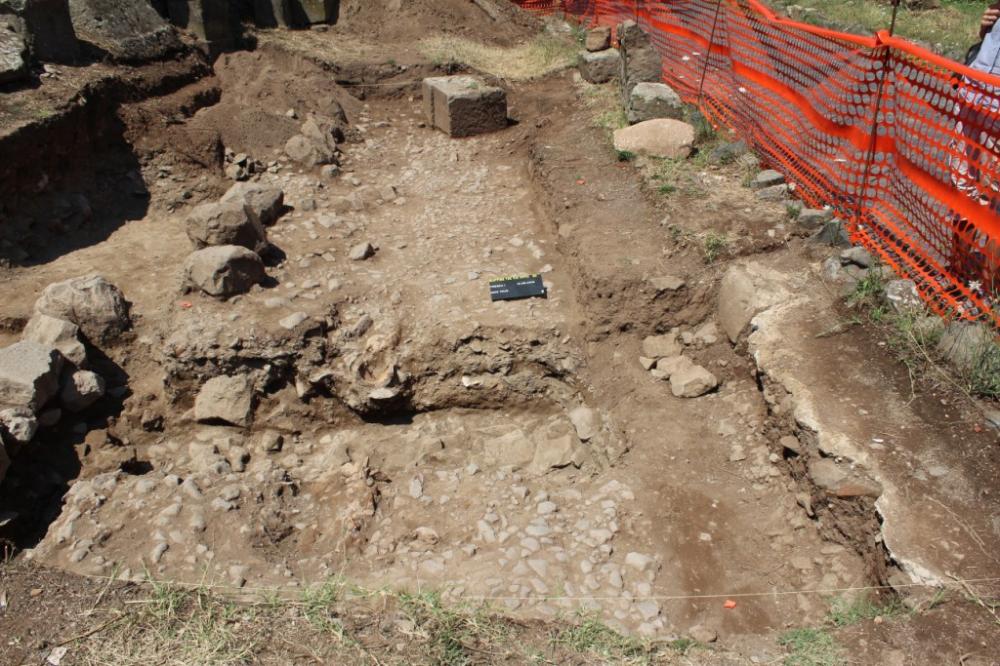
Several trenches were opened around the northern tumulus (so-called Tomb of the Orazii), extending those excavated in 2013 and 2014. Work concentrated on the east side of the northern tumulus, in the sector close to the road (1). Here various levels of beaten surfaces were excavated, perhaps relating to different phases of the sidewalk along the main stretch of the road. The foundation of the opus caementicium perimeter wall was reached to the west of the northern tumulus (2). This foundation projected from the wall and was situated at almost two metres below the top of the wall itself. Small irregular fragments of travertine, with a smooth upper surface, were embedded in the top of the foundation. Thus far, no evidence has been found that gives a date for the construction of the tumulus.
Cleaning was carried out on the walls visible around the funerary monument denominated ‘Laterizio Due’ (3), also situated at the V Mile, on the east side of the via Appia to the north of Santa Maria Nova. This work was undertaken in order to gain a better understanding of the various ancient, late antique and medieval phases and their stratigraphic relationships.
This season, inventory work (4) continued that carried out between 2009 and 2014 consisting of mapping the monuments using DGPS, photography and drawings. The aim is to create an archaeological map of the area, which can then be used as a base for more detailed analysis of this stretch of the Via Appia in Rome’s suburbio .
Linked to this project is the three-dimensional mapping (5) of the monuments adjacent to the via Appia itself and in its hinterland. This will be put into the GIS/SIT system, for which purpose a 3D GIS/SIT has been developed, which forms the basis for the visualisation of this stretch of the via Appia both for academic purposes and for use by the general public.
With funding from the Dutch CNR (National Research Council) it was possible to continue the survey of the terrain adjacent to the sector of the via Appia in question (6), which is being carried out by a team from the Dutch Institute in Rome (Jeremia Pelgrom). A geophysical survey is also in progress. The Archaeological Superintendency for Rome (Rita Paris) and the German Institute of Archaeology in Rome (Ortwin Dally) also particpate in the “Mapping the Via Appia” project.
- Jeremia Pelgrom - Reale Istituto Olandese a Roma
- Christel Veen - Radboud University Nijmegen
- Eric Moormann - Radboud University Nijmegen
- Stephan T.A.M. Mols - Radboud University Nijmegen
Director
Team
Research Body
- Radboud University Nijmegen
- Reale Istituto Olandese a Roma
Funding Body
- Netherlands Organization for Scientific Research
- Radboud University Nijmegen
![[PDF]](download.php?file=3110.jpg "Download")
![[PDF]](download.php?file=3111.jpg "Download")