


Summary (English)
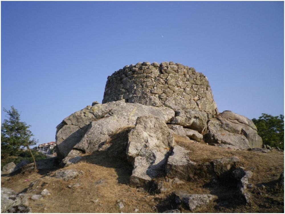
In 2012, the University of Bologna and Nuoro town council started a research project in the Tanca Manna Park located in the Su Nuraghe district of the town. This is the site of a Bronze Age village (BM2, BM3 and BR phases) made up of a single-towered nuraghe (fig. 1) and various residential structures. The project’s main aim is to complete the recovery, and enhancement of the archaeological complex and render it visitor friendly.
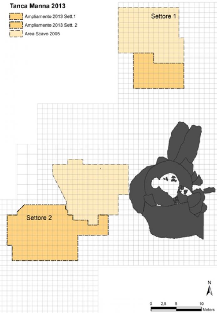
The 2013 campaign continued excavation of the structures uncovered by M. A. Fadda in 2005 (rooms 1, 2, 3, and 4) and enlarged the excavation area to the north (sector 1) and west (sector 2) of the nuraghe increasing the overall surface under investigation to c. 500 m2 (Fig. 2).
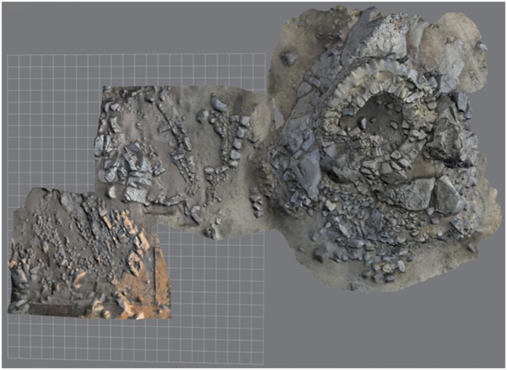
The on-site recording included a 3D survey of the nuraghe and the excavated rooms (Fig. 3).In sector 1, the excavation of room 1 was completed. This circular structure was c. 6 m in diameter and built with large granite boulders completed by various sized blocks. The excavation reached the floor level, mostly formed by bedrock, and documented the construction phases defined by the building of the walls and insertion of fittings inside the room (Fig. 4).
Sector 1 was also extended to the south with the aim of discovering the relationship between the excavated structures and the nuraghe. In this area several sections of walls were uncovered that require further extension of the excavation in order to discover whether they were actually part of rooms.
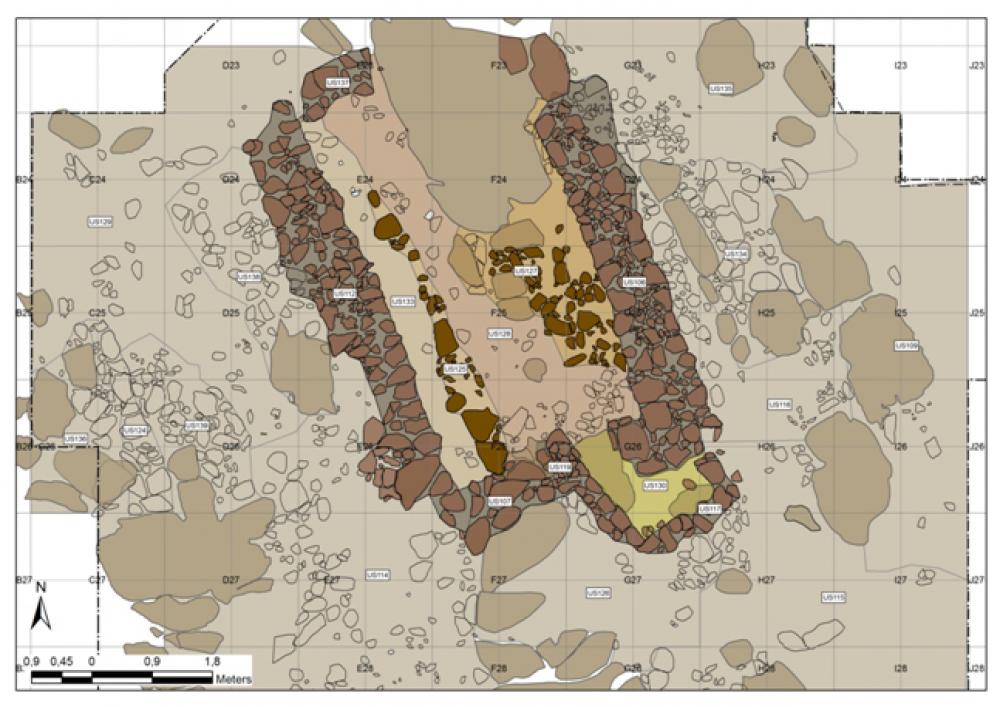
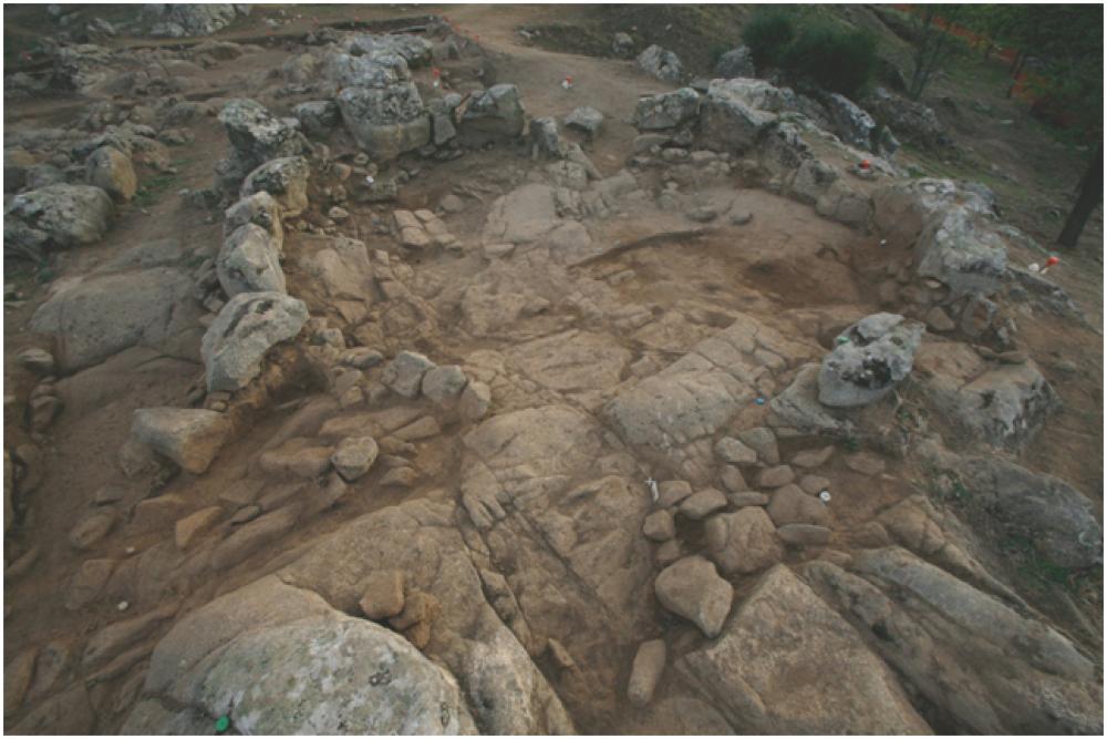
Sector 2 was also extended in the area south-west of room 3, characterised by a terrace that seemed to be man-made, bordered by outcropping granite boulders and a scarp on the west side. An occupation level was exposed immediately below the surface layer, with rows of stones that rested on large natural granite boulders and abundant pottery fragments. At the end of the campaign, most of the plan of room 5 was identified (Fig. 5). It was a rectangular room on a north-south alignment and with an area of c. 18 m2 (6 × 3.1 m).
Among the finds, pottery was the most abundant category, followed by obsidian flakes and spindle whorls and a moderate number of millstones and grinders. The medium and coarse impasto was very fragmentary and no complete vessels were found. Among the most interesting finds were several fragments of a jar with ribbing on the outer surface of the body, characteristic of the Sa Turricula phase and vessels with internal ledges, widespread in the Middle Bronze Age.
- Maurizio Cattani - Università di Bologna
- Andrea Fiorini - Università degli Studi di Bologna
- Florencia Debandi - Università di Bologna
- Demis Murgia - Comune di Nuoro
Director
Team
- Silvia Marvelli - Laboratorio di Palinologia, Laboratorio Archeoambientale, Centro Agricoltura Ambiente “Giorgio Nicoli”
Research Body
- Università degli studi di Bologna
Funding Body
- Comune di Nuoro
![[PDF]](download.php?file=1103.jpg "Download")
![[PDF]](download.php?file=1104.jpg "Download")
![[PDF]](download.php?file=1105.jpg "Download")
![[PDF]](download.php?file=1106.jpg "Download")
![[PDF]](download.php?file=1107.jpg "Download")