Summary (English)
Research (2009 and 2013)
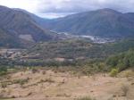
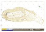
Located in the municipality of Villablino (León), this hill-fort is 900 m NW of this town. It covers an area of about 4ha on the southeast foothills of the Carabinos Blancos, on the sunny side of the main valley of the Laciana region. It is situated where the Sil and Río de Sosas rivers meet and elevated some 190m, overlooking the water meadow. The site has an elongated NW-SE shape and its highest point has an altitude of 1,178m. It comprises three occupation platforms separated by several fortified lines, successive ditches and various parapets and ramparts.
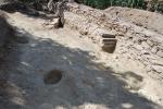
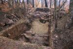
It had already been excavated in the late 1970s by a team at the University of Salamanca led by F. Jordá Cerdá but the results remained unpublished. Recent archeological interventions covering about 300 m2 have taken place in 2009 and 2013 within the framework of a project of enhancement of the castro settlement in the region.The sondages performed in different parts of the site revealed the SE closure of the acropolis. It is a notably wide wall with curvilinear layout, built with blocks of slate and quartzite. The walls of a possible hut were associated to it, as well as a basin where a falx-shaped iron knife was recovered. Excavations in the NW sector of the acropolis provided the most interesting data. Three phases of occupation were identified there: The first one probably dates to the late 8th century BC and continues all through the 7th century BC, with a double-thick wall built with slate masonry and filler material. Its layout was not adapted to the contour line but it climbs up the slope. Various post holes and underground structures, maybe used as storage room, are associated to the walls. The first wall, which was amortized during the second phase, is now buried and covered by a second drywall-construction fortress built using slate slabs. In the central area there is also a staircase adapted to the topography of the hill. This second occupation could have extended over the 6th and the 5th centuries BC, until the partial collapse of the building took place.
Finally, a third wall built upon the previous defensive structure, towards the SE, defines the third occupation phase. In other words, it constitutes a repair of the previous wall, undertaken at the end of the 5th century or the beginning of the 4th century BC. There is a stone terrace surrounded by a gradient on the outside surface, maybe added to provide greater consistency to the construction. The end of the occupation remains undetermined, but the settlement did not continue into the Roman period.
Recovered materials are very scarce: handmade pottery, which are undecorated and sometimes polished, small metal pieces and a lithic industry.
(translation by Laura González Fernández)
- Rubén Rubio Díez
Director
- Rubén Rubio Díez y Javier Quintana López (Alacet Arqueólogos, S.L.)
Team
- Rubén Rubio Díez, Francisco Javier Marcos Herrán y Javier Quintana López (Alacet Arqueólogos, S.L.)
Research Body
Funding Body
- Ilmo. Ayuntamiento de Villablino; Instituto para la Reestructuración de la Minería del Carbón y Desarrollo Alternativo de las Comarcas Mineras; Junta de Castilla y León.


![Download [PDF]](/excavation/skins/fasti/images/results/download_sml.png)


