


Summary (English)
Research (2005-2012)
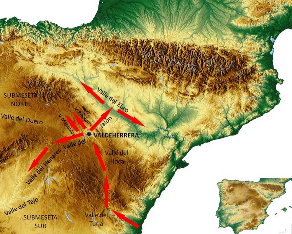
This is a key archaeological site for understanding how Rome conquered the Celtiberians and set up a process for transforming and controlling their territories. Situated on the left bank of the Jiloca, it occupies a low promontory overlooking the confluence of this river with the Jalon. It was therefore one of the nerve centres of the Celtiberians as it controlled access to two of the main routes used since ancient times to communicate between the Meseta, the Ebro valley and the east coast.
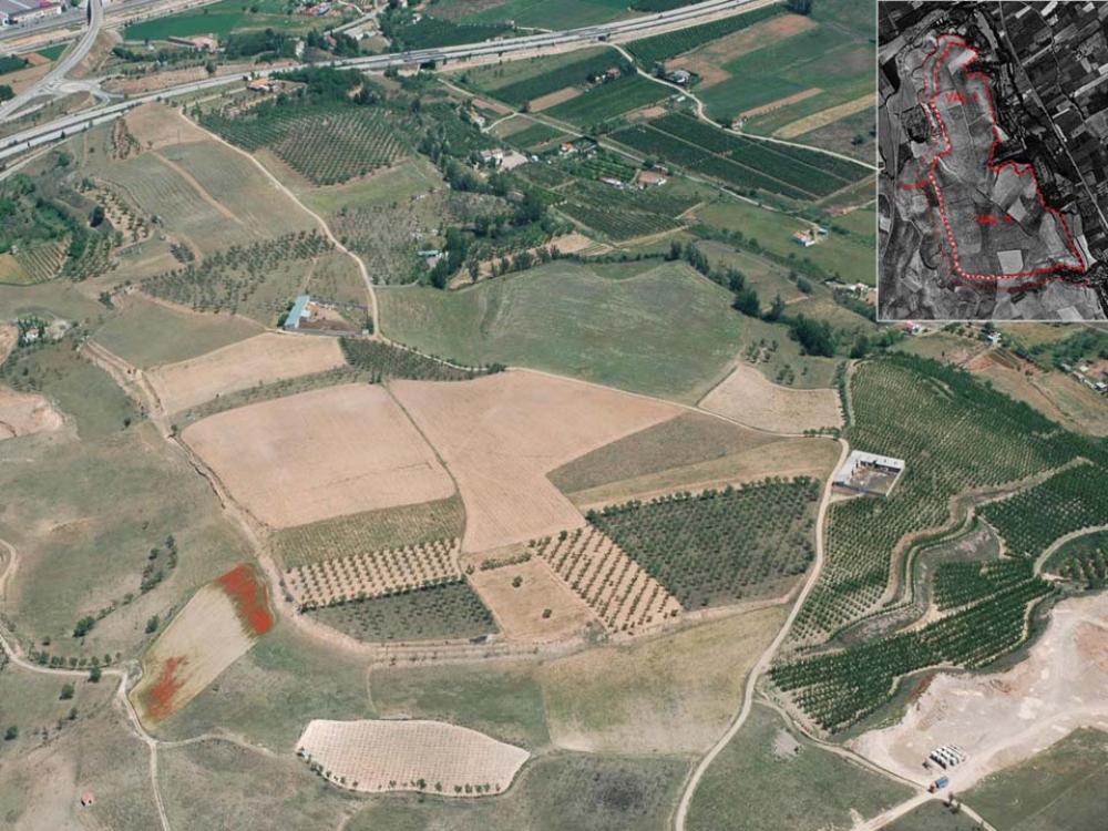
2005 saw the beginning of the ‘Valdeherrera Project’, which has included survey campaigns and geophysical studies. Between 2005 and 2009 the project was developed jointly by Bordeaux Montaigne University and the Department of Antiquity Sciences at the University of Zaragoza, with the collaboration of the Centre Littoral de Géophysique of the University of La Rochelle. Since 2010, however, the work has been coordinated by the University of Zaragoza. An extensive excavation programme has been implemented and has made it possible to mark out the boundaries of a 35-hectare Celtiberian town surrounded by deep moats. Various phases of occupation and destruction have been detected. Today one can speak of Valdeherrera I, located in the N of the promontory and destroyed during the Second Celtiberian War, and Valdeherrera II, located in the S and destroyed in Sertorian times. The identification of a small set of ceramic ware from the Middle/Late Bronze Age suggests there was an earlier settlement.
The archaeological excavations carried out on the Valdeherrera II site (25 ha) have confirmed the existence of an orthogonal plan clearly inspired by the Italic style. The streets were porticoed and the domus had tetrastyle atria; domestic rooms were richly decorated with opus signinum flooring and tessellated tiles on white mortar. ‘Pompeian Style I’ paintings have also been identified and could be the oldest examples in the Ebro valley.
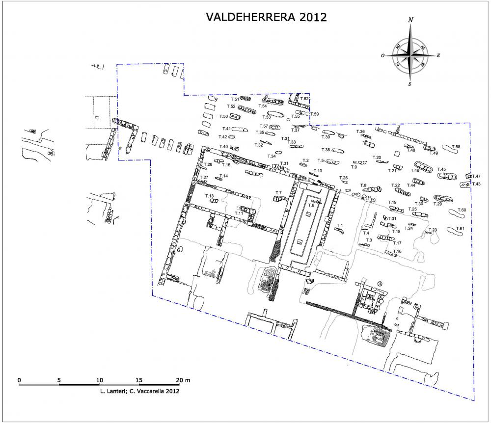
In the course of the 2012 excavations a Muslim necropolis or maqbara was found, dating to the second half of the 9th century. It is currently undergoing excavation and anthropological study.
- Carlos Sáenz Preciado y Manuel Martín-Bueno
Director
- Carlos Sáenz Preciado y Manuel Martín-Bueno (Universidad de Zaragoza)
Team
- Enrique García
- Claudia García Villalba; Oscar Bonilla Santander; Cristina Godoy
- Lourdes Oronich; Miriam Pérez
- Luca Lanteri; Corrado Vacarella
Research Body
- Universidad de Zaragoza; Museo de Calatayud.
Funding Body
- Dirección General de Patrimonio Cultural (Diputación General de Aragón) Ayuntamiento de Calatayud, Asociación de Amigos de Bilbilis y del Museo de Calatayud.

![[PDF]](download.php?file=1518.jpg "Download")
![[PDF]](download.php?file=1519.jpg "Download")
![[PDF]](download.php?file=1520.jpg "Download")
![[PDF]](download.php?file=1521.jpg "Download")