


Summary (English)
The Salapia Exploration Project was created to study the Roman and medieval town of Salapia, the most important of the known historical settlements within the territory of Saline di Margherita di Savoia, of which little is known in the period following its re-foundation by M. Hostilius at the end of the 1st century B.C.
A geophysical survey was carried out in an area west of Monte di Salpi (4 hectares) and a small zone (2 hectares) on its summit. So far, the results have revealed a large part of the town’s urban layout, with orthogonal roads and square insulae (c. 40 × 40 m).
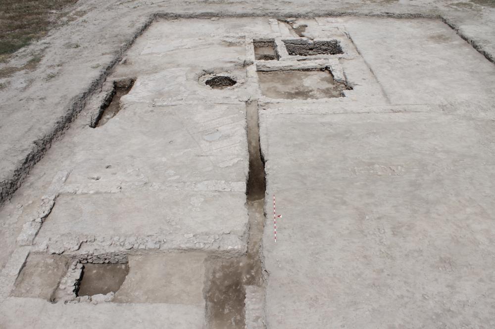
In 2014, two trenches were opened in correspondence with a complex nucleus of anomalies relating to structures and roads inside the town that showed up on the geophysical survey.
In trench 1, the excavations exposed the structures of what was probably a domus, whose original construction seems datable to between the second half of the 1st century B.C. and the 1st century A.D.
During the full imperial period (2nd-3rd century A.D.), the complex was enlarged with the addition of quadrangular rooms with mosaic floors.Between the 4th century and first half of the 5th century, the building underwent further restructuring which altered the interior spaces, repaired the earlier mosaics, and reinforced the walls. The creation of a cesspit, obliterating several earlier structures, probably dates to this period. Its function was to drain water from rooms situated beyond the excavation area and consequently not investigated.
From the second half of the 5th century onwards, changes occurred in the type of occupation within the probable domus. A number of rooms were abandoned and timber supports were inserted in other rooms as supports for roofing.
The complex was abandoned during the first half of the 6th century when dwellings built in perishable materials were put in place on top of the obliteration layers and several areas were used for funerary purposes.
In trench II, a section of a road was investigated, bordered by two building complexes with different functions.
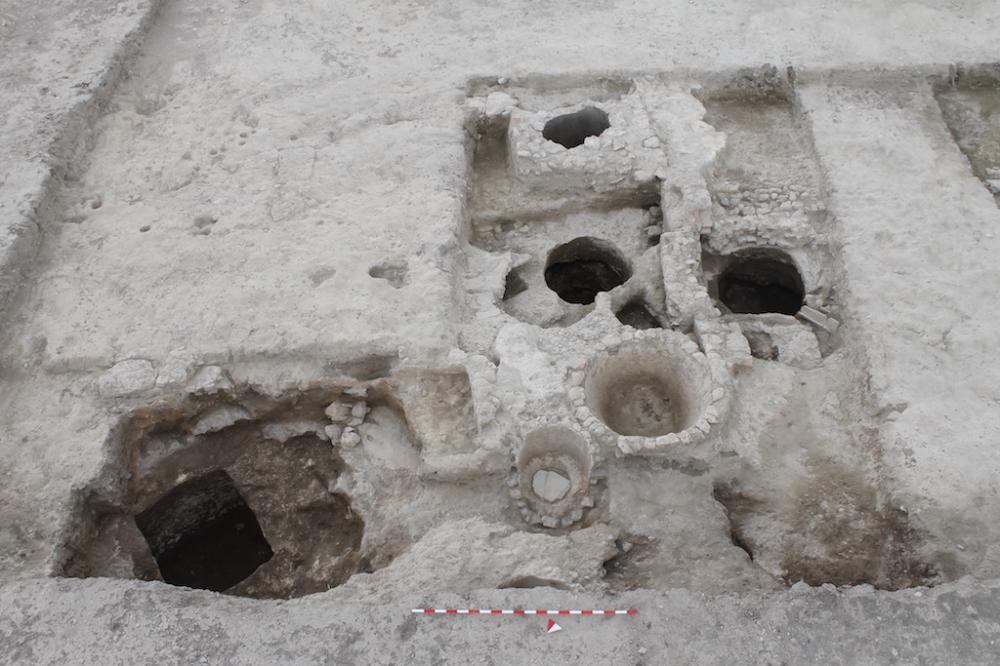
To the east, a craft-working installation was exposed, specializing in the treatment of textiles and hides, as attested by a series of circular and rectangular tanks. This complex may originally date to the full imperial period (2nd-3rd centuries), and gradually went out of use between the 4th and 6th centuries A.D.To the west, a room, perhaps a warehouse-workshop was excavated that produced numerous amphora fragments and a hoard of c. 400 small bronze coins. The sudden abandonment of the structure, marked by the collapse of the tiled roof, probably occurred in the second half of the 5th century.
As in other parts of the town, once the craft-working complex and warehouse-workshop went out of use, the area was occupied by temporary structures, attested by huts and beaten earth surfaces.
- Roberto Goffredo - Università di Foggia
Director
- Darian M. Totten - Davidson College
- Giovanni De Venuto - Università di Foggia
- Giuliano Volpe - Università di Foggia
Team
- Andrea Fratta; Vincenzo Ficco; Sara Loprieno; Debora di Nauta.
Research Body
- Davidson College (USA)
- Università di Foggia
Funding Body
- American Institute of Archaeology
- Loeb Foundation
![[PDF]](download.php?file=1685.jpg "Download")
![[PDF]](download.php?file=1686.jpg "Download")