


Summary (English)
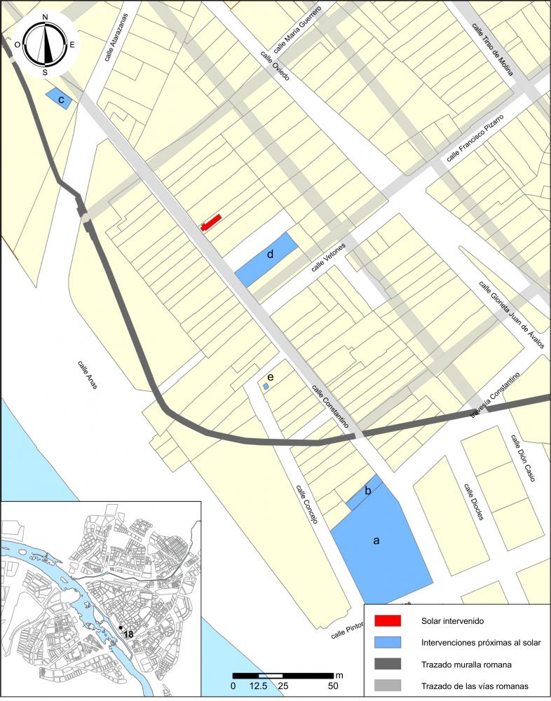
This site is located within the walls of the Emeritan colony, in an area close to the river Anas. In other parts of this street archeological excavations have already been carried out. These have shown the presence of industrial establishments, of different dates, of mainly pottery kilns.
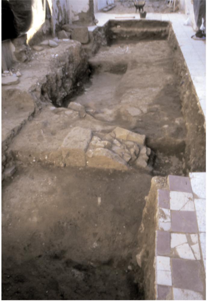
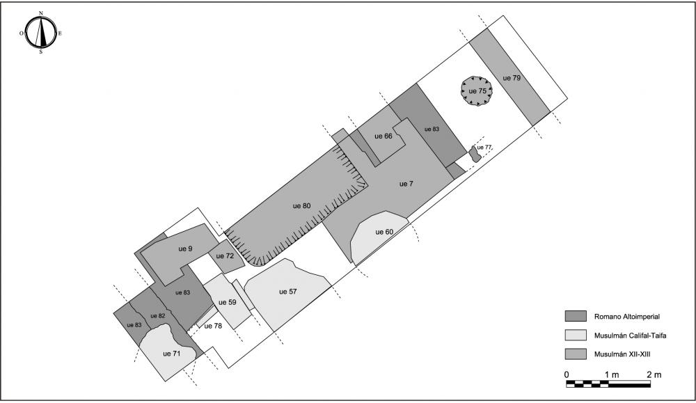
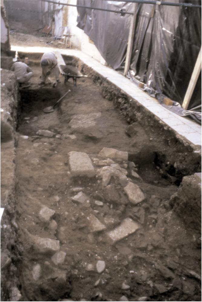
The current intervention is linked to the demolition of an architecturally traditional house in order to construct a new building. With this excavation, the aim was to collect data about the topography of the area, to determine its stratigraphic value down to Roman levels and to better understand the nature of the settlement of this area. The stratigraphy revealed two levels of Islamic medieval domestic settlement and a third level of Roman settlement, which was very destroyed, with several stratigraphic hiatus in between them.
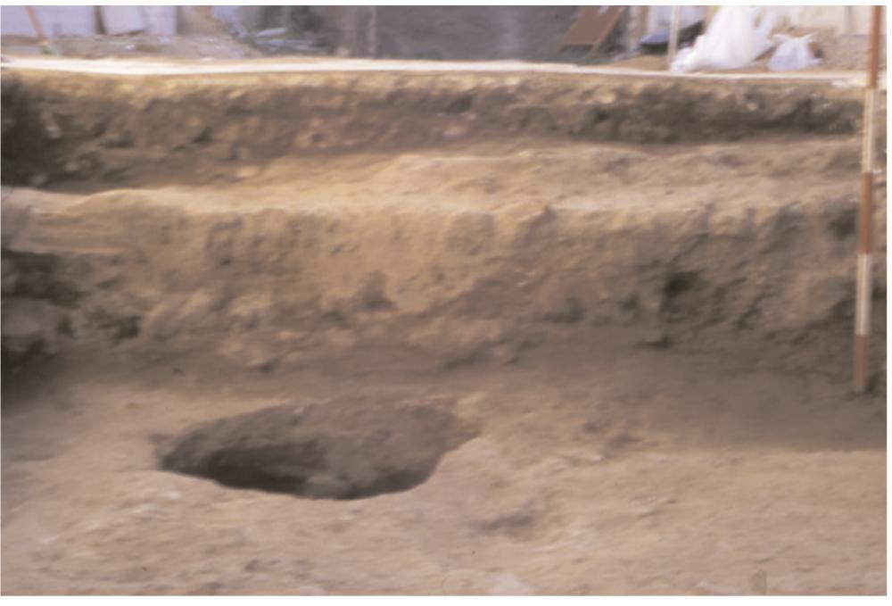
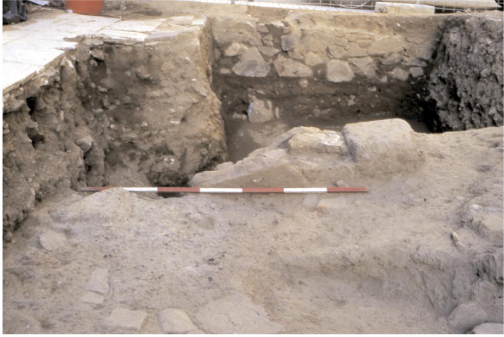
The excavated site is located on a relatively high point of the original topography which prevents it from accumulating deposits that would preserve the remains. There is barely more than 50 cm separating the present ground level from the ancient floor bed.
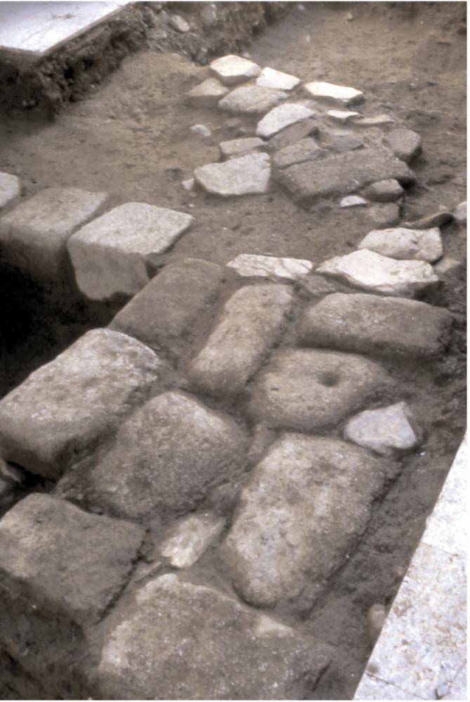
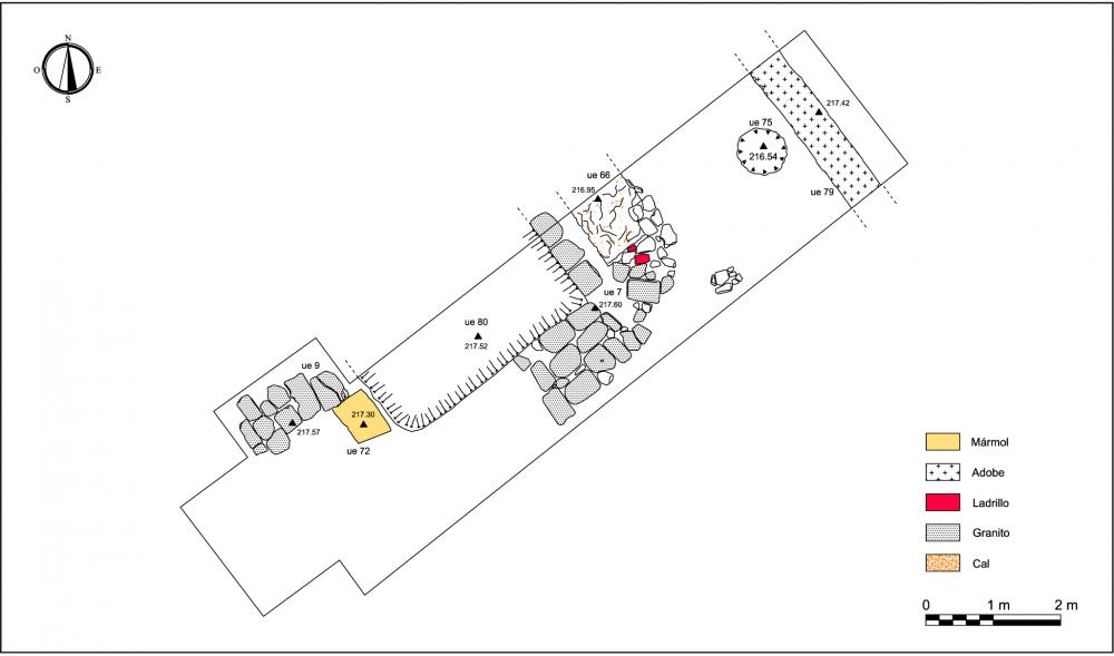
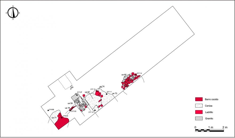
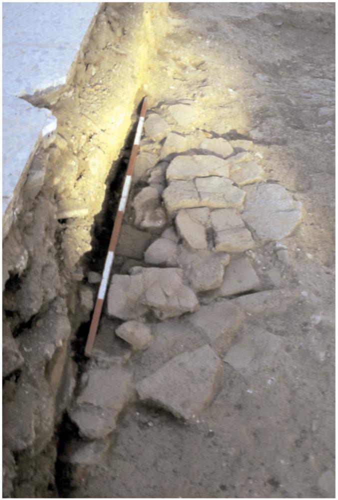
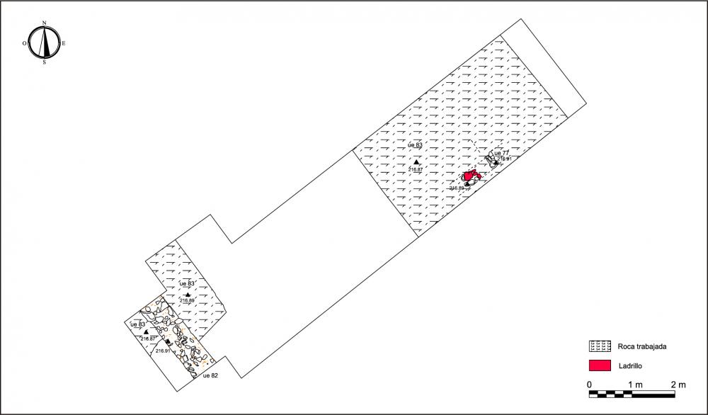
During the Roman period the rock was cut back to form a horizontal surface upon which constructions were made. There are ruins of two disjointed walls similar to other walls found in Mérida, associated with the first houses, constructed without the use of lime mortar.
Further along there is a jump of over a thousand years before one finds evidence of any kind of settlement. There are ruins from one or two Islamic houses, from Caliphate period, which were permanently abandoned in the 11th century. There is neither evidence of a hurried abandonment nor of a violent destruction.
In the 12th century the site was inhabited again, which is a common phenomenon in the development of the suburbs. By the end of this century the medina quarter was exposed to the pressure of the Christian kingdoms resulting in the abandonment of the houses. The Meridan archaeological settings reveal the abandonment of numerous houses and that the withdrawal of the population resulted in the construction of a new set of walls to defend the kingdom.
From the Christian conquest until the end of the 19th century this area remained free from constructions, but was used as an agricultural field on the outskirts of Mérida. The arrival of the railway and the commercial development in the early 20th century attracted a proletarian population which settled down in this area. Calle Constantino thus emerges, with its narrow and varied morphology, which it still preserves to a great extent.
The Roman structures were found to be much destroyed and the medieval ruins were dispersed and were of lesser value. Therefore, the new construction was built on top of a cement slab.
(translation by Esther Casares Carmona)
- Miguel Alba Calzado
Director
- Miguel Alba Calzado (Consorcio Ciudad Monumental de Mérida)
Team
- Miguel Alba
- Valentín Mateos
- Javier Pacheco
- Luis Martínez, José María Ramos
Research Body
- Consorcio Ciudad Monumental de Mérida
Funding Body
- autopromoción
![[PDF]](download.php?file=2934.jpg "Download")
![[PDF]](download.php?file=2935.jpg "Download")
![[PDF]](download.php?file=2936.jpg "Download")
![[PDF]](download.php?file=2937.jpg "Download")
![[PDF]](download.php?file=2938.jpg "Download")
![[PDF]](download.php?file=2939.jpg "Download")
![[PDF]](download.php?file=2940.jpg "Download")
![[PDF]](download.php?file=2941.jpg "Download")
![[PDF]](download.php?file=2942.jpg "Download")
![[PDF]](download.php?file=2943.jpg "Download")
![[PDF]](download.php?file=2944.jpg "Download")
![[PDF]](download.php?file=2945.jpg "Download")
![[PDF]](download.php?file=2946.jpg "Download")