


Summary (English)
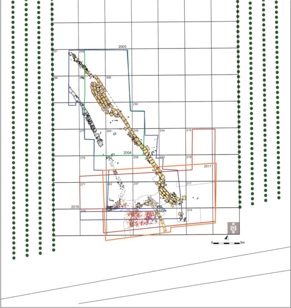
During the 2017 campaign in the urban area of Satricum, Amsterdam University continued excavations in the area of Poggio dei Cavallari. The investigations concentrated on area 2 in terrain belonging to the Casale del Giglio. Here several trenches were reopened and enlarged (see fig. 1: edges of the 2017 excavation area shown in red) with the aim of examining in depth the ancient structures identified within them.
In area 2, the research concentrated on the southern trenches partially excavated in 2004, 2005 and 2016, which revealed the presence of several stretches of wall that have been attributed to a side road branching off from the main road running E-W through the city. The excavation area was extended along the south side (fig. 2).
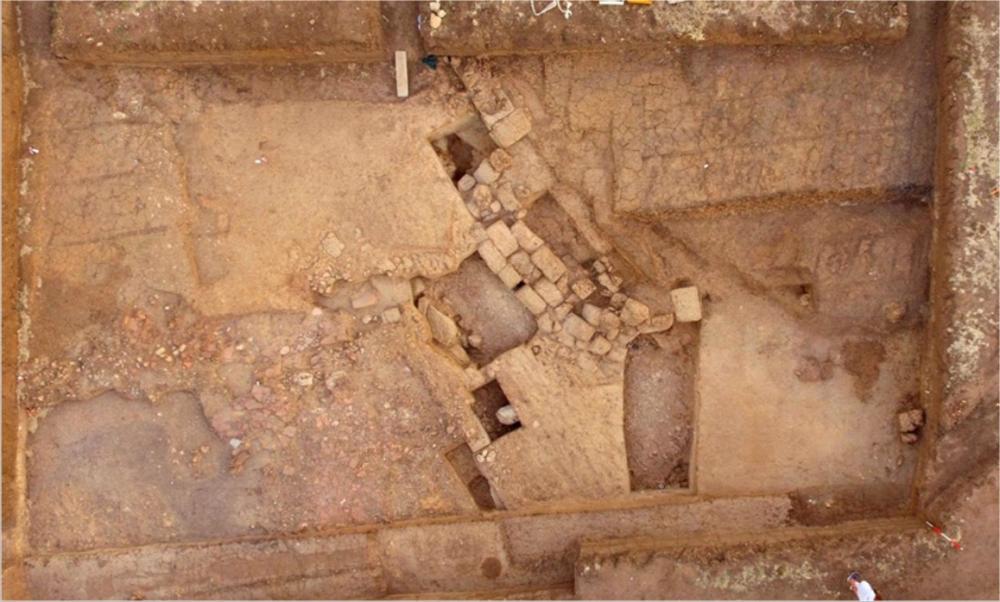
The southern side of the side road’s eastern retaining wall was cleaned. The sections of wall were also cleaned. The latter were made of rectangular blocks of tufo lionato positioned in slightly curved and parallel lines at different levels, sloping heavily to the west, down to c. 1.50 m below the modern level of the trench. At present, it is not clear whether the blocks were in their original position or had slipped to a lower one.
The blocks, surrounded by a thick layer of sand, are interpreted as a substantial rise in the preceding road level, which ran below the sand in the same direction. At the same time, the complex of blocks served as a sort of foundation on which there was another surface. During previous excavations, the remains of a compact tufa layer were found in correspondence with the upper level of the blocks, which were identified as the remains of a road make-up.A deep sondage opened in trench 232 on the western side of the complex of walls revealed an earlier surface or a make-up below a thick layer (c. 1 m) of rather clean sand. It lay directly on natural that presented numerous large holes possibly relating to Iron Age activity. The natural layer also sloped down towards the south, which continued beyond the south side of trench 231.
In trench 246 and the eastern part of trench 261, the cleaning continued of a compact layer of tegulae and imbrices that was discovered in 2016. Two different layers were identified below the tegulae. The first layer consisted of large and small fragments of coarse ware pottery crushed on top of the second layer composed of cobblestones. The recognisable pottery forms included a large bowl and a large basin (excavated in 2016) and numerous domestic forms including a second smaller and almost complete bowl. Generally, the other forms were not complete. The level of cobblestones surrounded by walls on the eastern and northern sides probably constituted a floor surface relating to a courtyard or workroom.
- Marijke Gnade – Università di Amsterdam, ACASA
Director
- Marijke Gnade – Università di Amsterdam, ACASA
Team
- Desiré Steures - Università di Leiden
- Loes Opgenhaffen - Università di Amsterdam
- Martina Revello Lami - Università di Amsterdam
- Jesús García Sánchez – Università di Leiden
- Jitte Waagen - Università di Amsterdam
Research Body
- Università di Amsterdam, ACASA
Funding Body
- Azienda agricola ‘Casale del Giglio’
- Università di Amsterdam, ACASA
![[PDF]](download.php?file=6395.jpg "Download")
![[PDF]](download.php?file=6396.jpg "Download")