


Summary (English)
During the study of the data from the excavations at Musarna carried out by the École Française de Rome, between 1983 and 2003, research undertaken by Giuseppina Cinque (Dept. of Engineering, University of Tor Vergata, Rome) led to the formation of a hypothesis regarding the site of the point at which the urbanisation of the ancient town, founded in about 320 B.C., began.
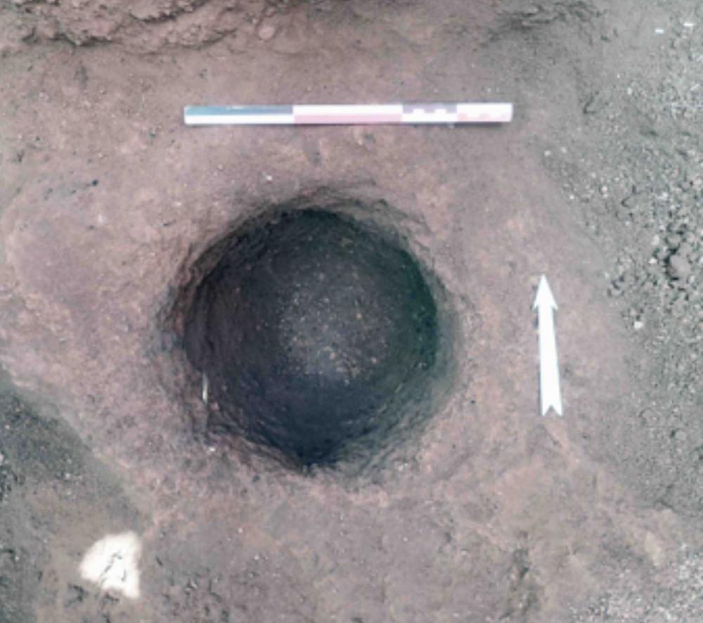
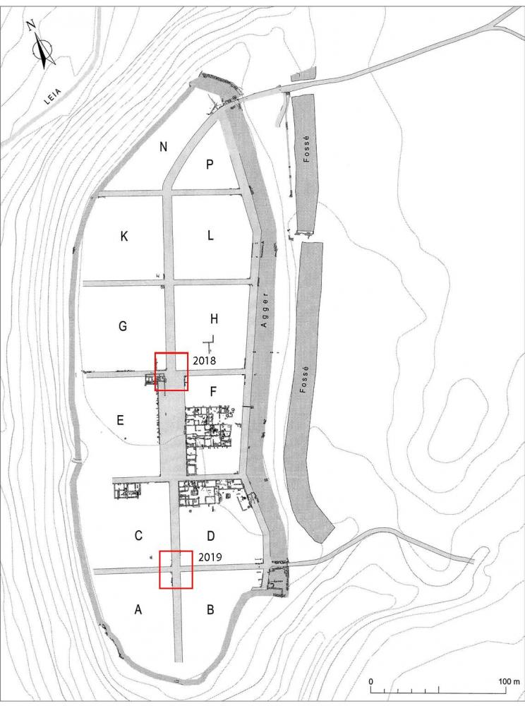
This point, designated in archaeological literature as the mundus or locus inaugurationis, could be marked by sacrificial remains, by a ritual cavity, or, as at Marzabotto, by a large cobblestone bearing a decussis. In 2018, a 2 m trench excavated in this exact point, at the far end of the forum, and at the centre of the cardo (Fig. 1), revealed a posthole cut into the tufa bedrock. It was 29 cm in diameter and reinforced with stones and tile fragments. The posthole contained charcoal fragments (Fig. 2), and was sealed by a layer of imperial date. This could be the place where the gnomon was positioned that was used at the beginning of operations to determine the layout of the town’s principal road axes. However, the charcoal fragments found in the hole have been dated by C14 analysis to between 138 and 339 A.D., therefore apparently incompatible with such hypothesis.
In 2019, it was decided to check for the possible presence of a similar feature at another important crossroads, that between the north-south cardo and the decumanus separating insulae A-B to the south from insulae C-D to the north, which led east to one of the town’s gates. The trench (Fig.1) was positioned in order to cover all possible theories (position at the centre of the crossroads; aligned with the north wall of insulae A-B; aligned with the south wall of insulae C-D). The excavation revealed the complete destruction of the stratigraphy in this zone, caused by agricultural activity. The tufa bedrock, exposed across the entire trench, in contact with the layer of ploughed soil, presented only a few small channels converging towards a drain (Fig. 3).
- Vincent Jolivet
Director
- Vincent Jolivet, CNRS (UMR 8546)
Team
- Edwige Lovergne, CNRS (UMR 8546)
Research Body
- CNRS
- ENS
Funding Body
- CNRS
- ENS

![[PDF]](download.php?file=10295.jpg "Download")
![[PDF]](download.php?file=10296.jpg "Download")
![[PDF]](download.php?file=10297.jpg "Download")