


Summary (English)
This archaeological site was discovered at the end of the 20th century thanks to fieldwork carried out by the Alcoy Archaeological Museum and other subsequent excavations. It is a vast zone of undulating land, which currently consists of terraced fields. Previous investigations had revealed the existence of a rural, Iberian settlement linked to the territory of La Serrata, which after having been abandoned continued to exist until the end of the Late Imperial Roman period.
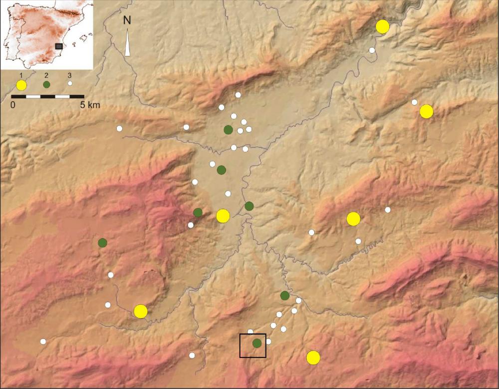
Given these characteristics, archaeological activities were planned to analyze ancient rural occupation and its role in land-use planning in the Iberian and Roman territories. GPS, GIS, geophysical survey, and digital cartography were used to register and document evidence. The intensive and complete exploration was conducted over an area of 18.5 hectares and allowed for the recovery of 2,796 Iberian and Roman sherds. The geophysical surveys carried out in zones with a higher density of superficial remains have not confirmed the existence of buried structures. The negative results have been corroborated by surveys; however, the abundance of fragmented tegulae and imbrices is indicative of the presence of Roman structures. Additionally, stone blocks from housing structures that had been knocked down by successive land removal have also been found. In short, constant agricultural work has contributed to the destruction of insignificant constructions whose walls, roofs, and pavements are spread widely throughout the analyzed area.
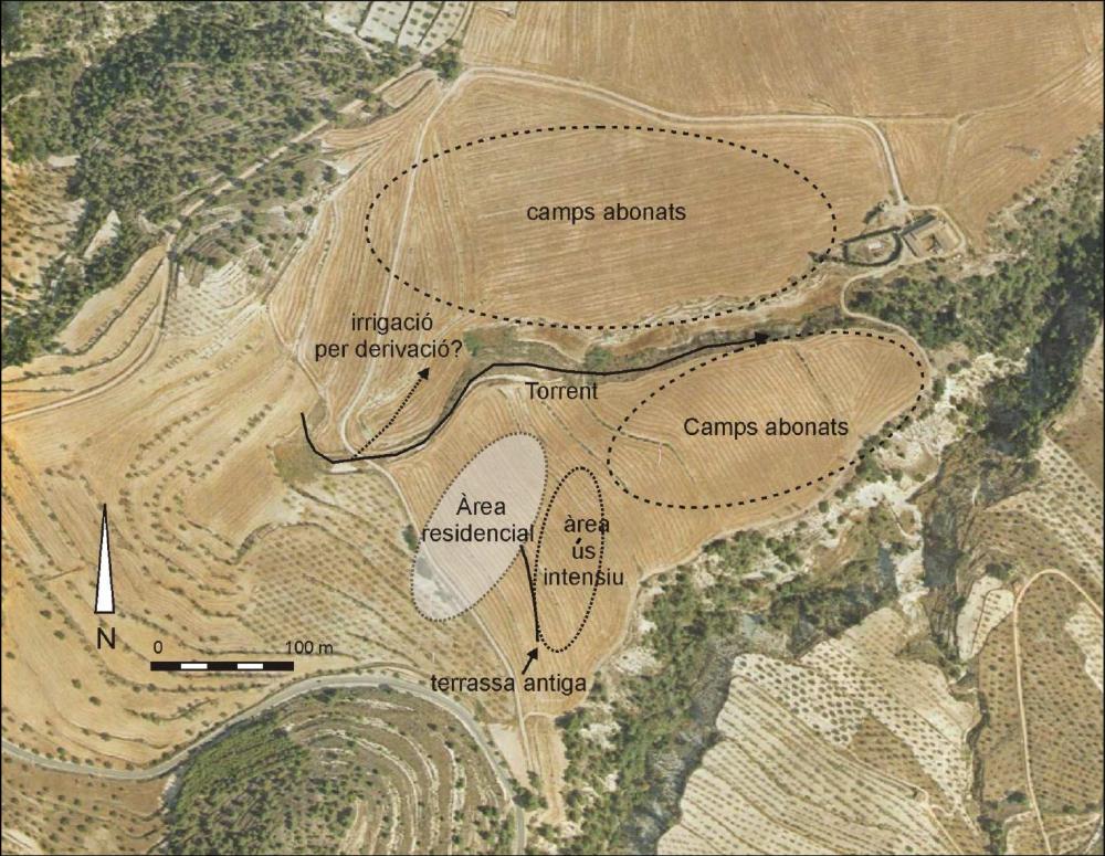
The remains from the Iberian occupation are spread irregularly over an area of about 15 hectares. The majority of the potsherds are from storage and kitchen vessels, as well as amphora, pointing to a space for residential use. Nevertheless, the whole area cannot be considered as one single living space. The distribution of the finds indicates that it could in fact be an agglomeration of several housing units situated on a terraced area. There are no solid constructions on this establishment. Furthermore, a peripheral zone on a lower terrace has been detected where a smaller quantity of ceramic fragments – possibly moved or dragged to zones that may have been used for cultivation – has been recovered. These low-density scatters of materials around the housing units and their surroundings are common in Mediterranean landscapes and could respond to fertilization with domestic refuse.
The Roman remains draw a much simpler pattern between the end of the first century BC and the end of the second century AD. From the mid-second century AD to the mid-seventh century AD, the amount of human activity in this area was considerably diminished. Archaeological surveys using GPS, digital cartography, and geophysical surveys have made it possible to obtain documentation for characterizing this rural site in a short time and on a low budget. Despite the fact that the ground has been greatly affected by agricultural work, archaeologists were able to identify the main lines of the settlement patterns.
(translation by Emily Marie Polacek)
- Ignasi Grau Mira y Josep Mª Segura Martí
Director
- Ignasi Grau Mira y Josep Mª Segura Martí
Team
- César Carreras Monfort, Pau de Soto Cañamanes, Jaime Molina e Ignasi Segura Martínez
- April Nowell Phd
- Carlos Cordova
- Michael Bisson
- Museo Arqueológico Municipal Camil Visedo Moltó
Research Body
- Colegio Oficial de Doctores y Licenciados en Filosofía y Letras y en Ciencias de Alicante - Sección de Arqueología
Funding Body
- Ayuntamiento de Alcoy
![[PDF]](download.php?file=3289.jpg "Download")

![[PDF]](download.php?file=3290.jpg "Download")

![[PDF]](download.php?file=3291.jpg "Download")
![[PDF]](download.php?file=3292.jpg "Download")