Summary (English)
Our archaeological excavations carried out in 2002 and 2003 on Quintana Street, as well as the performances carried out in the plot of Nueve de Octubre Street, directed by A. Espinosa Ruiz, brought to light the first remains of the Iberian necropolis of Poble Nou. Both interventions have enabled a stratigraphic view of the area. In order to do so, in our action project we planned an exploration zone and an open-area excavation zone from the area affected by the necropolis.
The area to excavate had a totaled 2,150 m2. We carried out 11 excavation trenches, northeast-southwest oriented, with a maximum distance of 7 m between each one. The results of the excavation were negative.
The excavations revealed a number of tombs included in two different phases:
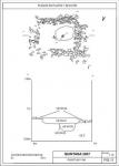
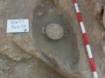
- From Phase I, seven tombs with decomposed adobe and charcoal levels as well as two possible sacrifices were located. Most of them (Points 81, 83, 85, 90 and 100) are simple pit tombs with oblong floors following an east-west orientation. Point 87 corresponds to an incineration tomb of oval section and point 84 corresponds to a simple pit tomb with rectangular floor. Two possible sacrifices appear associated with the tombs. The grave goods recovered consist of bone fragments, a gold barrel-shaped bead, spring fibulae and bronze annular, bronze rings, an iron hoop, Attic pottery bowls of black varnish, ointments flasks of common ceramic, spindle whorls and glass fragments.
- For Phase II we found two road sections in the intervention area: the first one was located in the southern part of the excavation (Stratigraphic unit 10), oriented north-south, consisting of a pitching of medium-sized river pebbles, embedded on a slightly hardened surface, which could be clay, tamped with some lime, imperceptible at first glance. The conservation status is irregular; the best-preserved flank is the western one and the strip that runs through the central space. This shows the attrition and loss of pitching in the area that matched the ruts of the carriages. The level of stones was placed on a bed of sand mixed with small gravel.
- On the other hand, another section of road (Stratigraphic unit 9) is located in the area located in the northern part of the excavation. It is very similar to the features of Stratigraphic unit 10: pitching of medium-sized river pebbles bonded with mud, irregularly preserved. A modern pipe trench divides this section.
(translation by Sandra Herrero Perucha)
- Diego Ruiz Alcalde y Amanda Marcos González
Director
- Diego Ruiz Alcalde y Amanda Marcos González
Team
- Museo Arqueológico Municipal de Villajoyosa
Research Body
- Colegio Oficial de Doctores y Licenciados en Filosofía y Letras y en Ciencias de Alicante - Sección de Arqueología
Funding Body
- Ayuntamiento de Villajoyosa


![Download [PDF]](/excavation/skins/fasti/images/results/download_sml.png)


