


Summary (English)
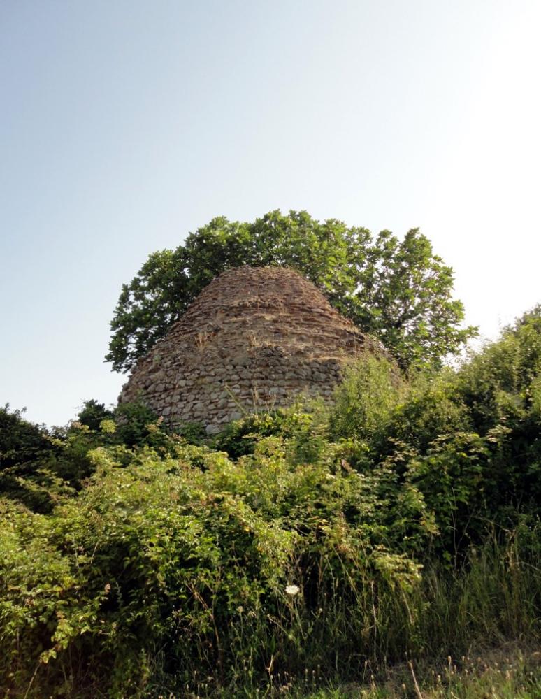
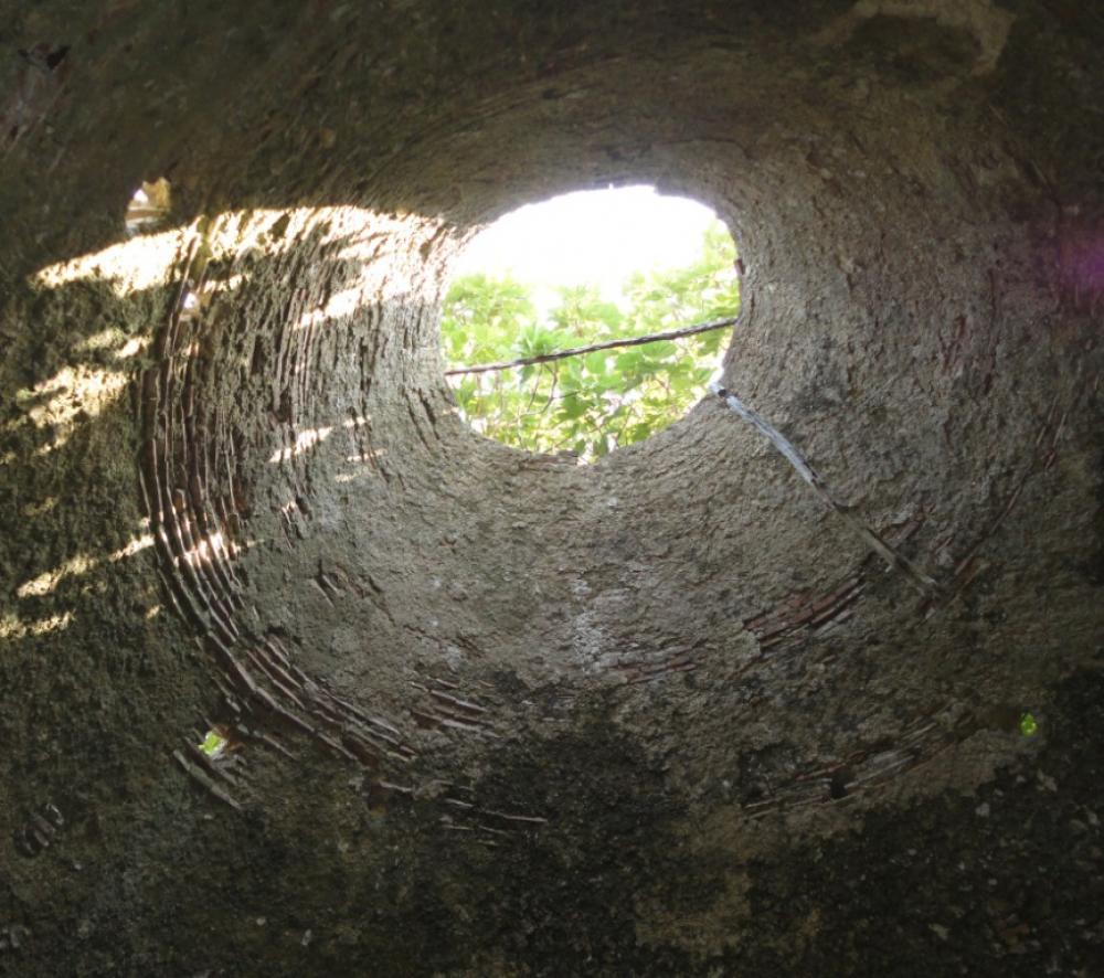
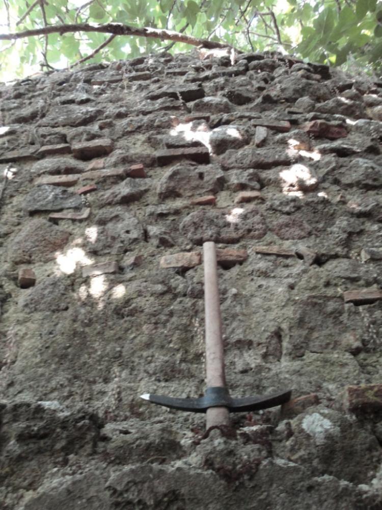
The annual campaign of topographical-archaeological research and surface survey was part of Siena University’s project ‘Sabatia Stagna’ on the Roman occupation of the area around modern Lake Bracciano. Among the remains of the modern houses situated on the north-eastern slopes of Mt. S. Vito (west of Mt. Arsiccio), the so-called walled hut was discovered (at c. 360 m a.s.l.; fig. 1). This was part of a late Roman structure that was partially altered after the antique period, constituted by a hexagonal room (max. Diam. 3.9 m; the door to the south-west the only aperture) on whose walls, originally in opus vittatum (fig.2), a chimney vault had been built (fig. 3). The room was probably part of a baths complex, of which the ‘walled hut’ is the only almost-intact part.
The type of wall finds close parallels in the Sabine area in two other late antique villas: in the apse of the baths (later a church) and in the cistern at the entrance to the villa of the Muracci di S. Stefano (Anguillara Sabazia), whose construction began in the early 3rd century A.D. (as documented by a tile stamp CIL XV 687), as well as the walls of the 3rd century-early 4th century A.D. villa of the fosso di Casalino (Trevignano Romano).
Along the hillside immediately above the ‘walled hut’, part of the rim and vertical handle of a jug in light coloured clay was found together with tile fragments. Dating to the early 4th-early 6th centuries A.D., it confirms the presence of a vast residential structure, at least at the beginning of the 4th century A.D., which at the time occupied the base (baths area) but also part of the north slope of Mount S. Vito. The latter, is still a marginal today (between the municipalities of Bracciano and Manziana) and was such, between the castrum Brachiani and the castrum S. Pupae, already in the medieval period, as indicated in the arbitration of the 10th January 1234 (transcribed in Calisse 1887: 441-442). Despite the substantial overlapping of the borders between the two castra with the present day border between the territories of Bracciano and Manziana, the medieval limes was shorter than the present day one. Considering that, on a par with the municipality of Manziana, the castrum S. Pupae extended towards the south-west as far as the border with the castrum Iuliani (modern Castel Giuliano; cf. Calisse 1887: 458), there must have been a third state entity, situated where the borders described in 1234 stopped, that is in correspondence with Mount S. Vito (and the adjacent Castagneta). Therefore, the area of S. Vito must have been occupied by a settlement that pre-dated the formation of the castrum Brachiani, which suggests it was originally in the form of a domusculta or at least continuity from the late antique period, the latter period now attested by the ‘walled hut’.
- Giuseppe Cordiano - Università degli Studi di Siena
Director
Team
- Enzo Ramella-Associaz. Terre degli Orsini
Research Body
- Univ. di Siena
![[PDF]](download.php?file=4359.jpg "Download")
![[PDF]](download.php?file=4360.jpg "Download")
![[PDF]](download.php?file=4361.jpg "Download")