


Summary (English)
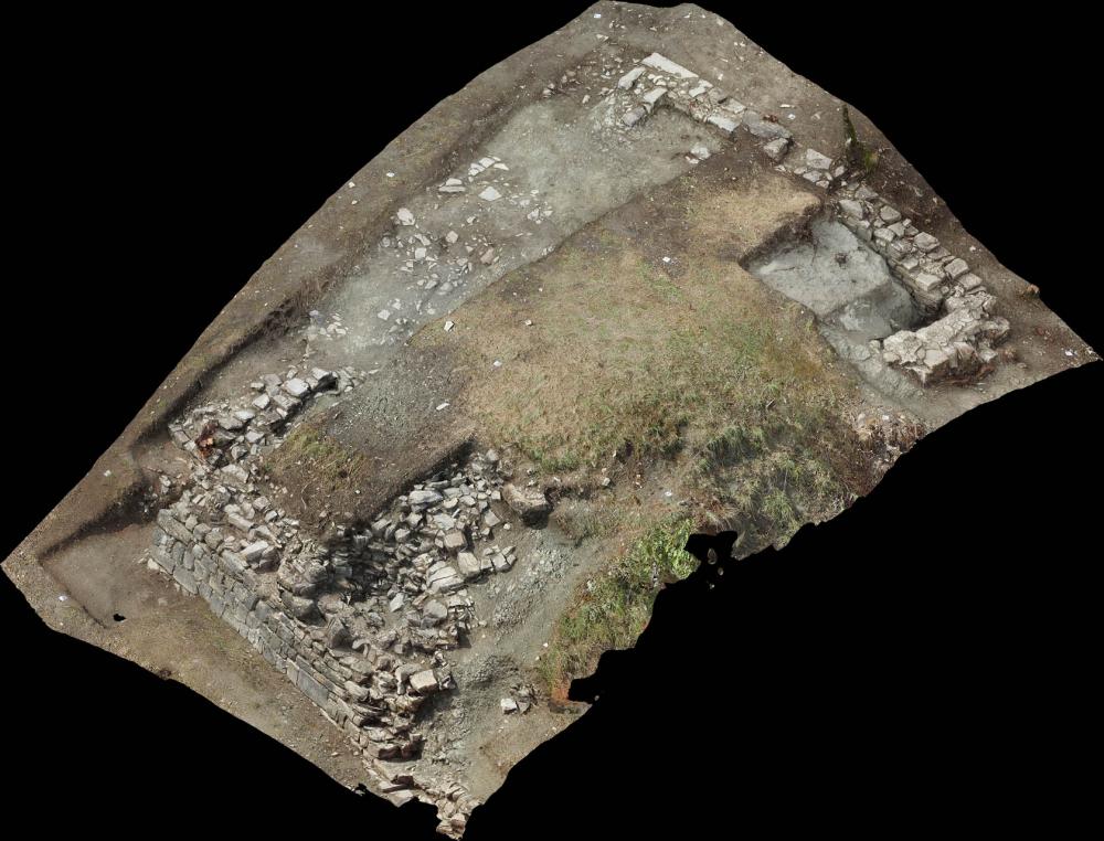
The archaeological site of Castel Pizigolo lies in the territory of Toano, not far from Monzone and Castagnola. Situated on the border between the provinces of Modena and Reggio Emilia, the medieval settlement stands on the left side of the Dolo torrent, in a strategic position for controlling the sulphur and salt water springs at the base of the hill that it occupies. Today, woods or meadows occupy the area. No standing remains are visible with the exception of a small section of medieval wall that was reused to create a small terrace on part of the hill. Topographically, the site appears to be made up of three distinct morphological elements. On a precipice above the Dolo there is a small summit entirely covered in vegetation on which a preliminary survey suggests a tower must have stood, as suggested by the presence of small bumps on the terrain. In a rearward position, in the direction of present-day Castagnola, there is a small irregularly shaped hill on which the only section of medieval wall is situated the. Between these two topographic elements lies a small flat intermediate area. Outside of this sector, the archaeological site presents an irregular morphology, characterised by small flat area, a number of terraces and walls, which lean heavily due to substantial erosion that has radically altered the area’s original topography.
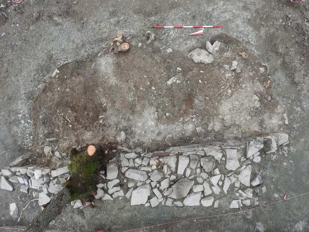
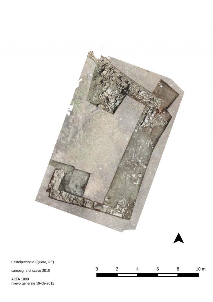
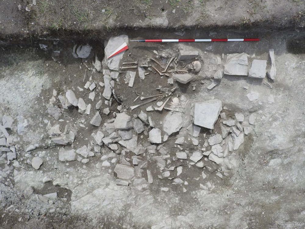
This was the first campaign of excavations carried out by the Alma Mater Studiorum, Bologna University, Department of History, Culture, and Civilisation; three areas were investigated. The first was on the hill with the visible wall, which was seen to belong to a building with several phases. The presence of burials aligned with one of its perimeter walls suggests it was a church, whose presence is known from the written sources. The finds date the religious structure and associated necropolis to between the 13th and 14th centuries. An earlier wall was also found, whose function and chronology are difficult to interpret at present. A second excavation area was opened on the level ground between the two hills, where three small trenches revealed the first medieval occupation levels on the site, datable to between the 9th and 10th centuries, as attested by fragments of cooking wares and soapstone. Lastly, the remains of a building (partially collapsed) were investigated, datable to the 13th and 14th centuries, which had been abandoned following a fire. Interesting finds included an iron spur and a small sickle in a very good state of preservation. Numerous sections of the mud-brick interior walls were found, which showed clear signs of the building technique and constitute an exceptional find.
- Nicola Mancassola - Università degli Studi di Bologna
Director
Team
Research Body
- Alma Mater Studiorum, Università di Bologna
Funding Body
- Comune di Toano (RE)
- Tecton soc. coop.
![[PDF]](download.php?file=4336.jpg "Download")
![[PDF]](download.php?file=4337.jpg "Download")
![[PDF]](download.php?file=4338.jpg "Download")
![[PDF]](download.php?file=4339.jpg "Download")