Summary (English)
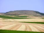
The site is located on the top of a hill of 1,349 metres high above sea level and 100 metres above its foundations. This privileged strategic position allows it to have a wide visual control of the surroundings.
Two decades ago explorations were made, during which materials from different periods were retrieved (Cebolla, 1992-93). Years after that, on top of the hill and on the hillsides, ceramics which dated from the Late Bronze Age, Early Celtiberian and Late Celtiberian were retrieved (Valiente, 1997). It was for that very diversity of this information and our knowledge of the place what made us decide to plan a systematic intervention in La Cabeza del Cid in 2014.
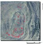
The medium-term plan started with a systematic evaluation of the archaeological potential. Before fieldwork activities started, we examined the materials from the site that were placed in the Guadalajara Museum. We also examined the available aerial photographs in detail, which clearly reveal the existence of different constructions. All this evidence allowed a new interpretation to be made for this settlement, which we consider to be a camp of the Roman Republican period.
We carried out an intensive and complete survey without trial trenches to cover the inside of the walled area, moat and immediate surroundings in order to define the structures and recover archaeological materials.
On the top and the slopes, we retrieved stone and ceramic materials that date back to the Neolithic-Copper Age. We also found numerous ceramic fragments from the First Iron Age, similar to the ones retrieved in previous publications. But there are also different materials between the 2nd and 1st centuries BC.
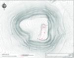
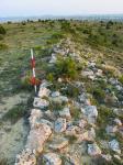
Once the interest of the place was confirmed, the site was georeferenced and a topographic map of the top of the hill and the identified structures was created. No structures have been identified in the interior of the camp enclosure. This has an area of almost 4.6 ha and is located in the south-eastern end of the wide plateau, where the top of the hill reaches its maximum height. It is delimited by a wall in the western and northern sides, whereas in the southern and eastern sides steep rock outcrops act as a natural defence system.
The construction technique, the size and the design of the settlement corresponds to those of Roman military enclosures. The walls, built with precision, show pronounced differences with the walled structures of the indigenous oppida from the Roman-Celtiberian period.
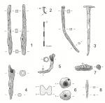
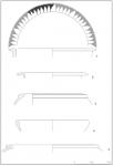
The recovered metallic pieces are elements of the Roman military equipment. Among these, the most outstanding are a quadrangular iron point in the “Numantian style”, a pilum with a square section tang and nails of quadrangular section finished in a T shape that might have been used in the tents. Among the ceramics, all of them from the Celtiberian period, the most important ones are the kalathoi and the large earthenware jars ilduratin with a corrugated edge, linked to the supply of the Sertorian troops. Both types of materials date from the two last centuries BC, especially from the 1st century BC.
The overwhelming presence of Celtiberic ceramics, as well as the absence of imported tableware, are indicators that the largest part of the military units that took part in those armed conflicts were recruited from the local population, as the classical texts frequently say.
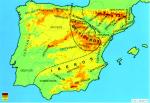
The identification of the camp at Hinojosa has provided new data on the Roman presence in Celtiberia and on the battles that took place in the eastern territories of the Iberian Plateau. It widens the archaeological evidence, which was focused on the Numantian camps until now, and it allows the verification of the information provided by the written sources.
(translation by Andrea Jorde Pérez)
- María Luisa Cerdeño Serrano
- Emilio Gamo Pazos
Director
- Emilio Gamo Pazos (UNED-Madrid)
- María Luisa Cerdeño Serrano (Universidad Complutense de Madrid)
Team
- Museo de Guadalajara
Research Body
- Universidad Complutense de Madrid
Funding Body
- Junta de Comunidades de Castilla-La Mancha


![Download [PDF]](/excavation/skins/fasti/images/results/download_sml.png)
