


Summary (English)
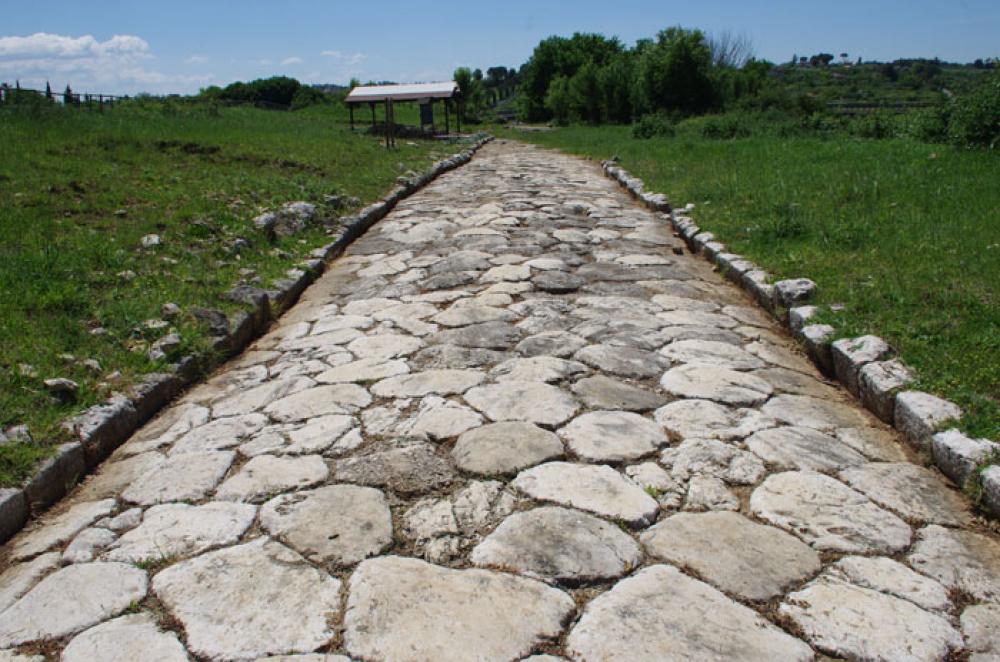
The archaeological area of Nomentum-Eretum is situated in the locality of Tor Mancina at Monterotondo (Rome), within the area of the CREA and Macchia di Gattaceca and Macchia del Barco Reserve. The excavations uncovered a stretch of Roman road and associated cemetery area.
The section of road was part of the via Nomentum-Eretum constituting the continuation of the via Nomentana, which having exited the urban centre of Nomentum joined the via Salaria at Eretum. Strabo called this stretch Nomentana. Travelling its last 3 km parallel to the via Salaria, it constituted an alternative to the latter, particularly in those periods of the year when the Piana Tiberina was flooded by the Tiber. At present uncovered for a length of 140 m, the section at Tor Mancina runs in a straight line towards the north and was built of limestone basoli, a material that is abundant in the area.There was a cemetery area on either side of the road, in use between the 1st century B.C.-1st century A.D. and the 2nd-3rd centuries A.D. There were two phases characterised by the presence of different tomb types and spatial orientation. Six burials dated to the first phase, all well-built and situated in a clearly visible area facing the road. Two of them (nos. 1 and 4) were situated inside a private burial enclosure. The second phase was represented by twenty-six graves, which seem to have occupied the spaces left free by the first phase tombs, conditioned by pre-existing structures and mainly distributed within the burial enclosure.
The processing of the archaeological data and typological analyses of the burials seem to suggest that the phase one burials were those of middle-high ranking individuals, while those in the graves seem to belong to the lower or poorer classes. The first were probably the owners of the nearby villae rusticae, while in the second case the individuals were probably the slave workers from the villas.
Area “Pietrara”
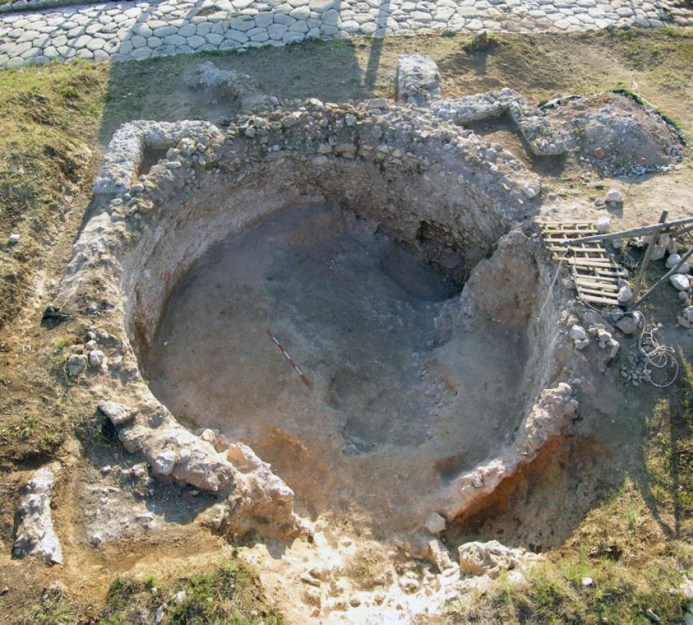
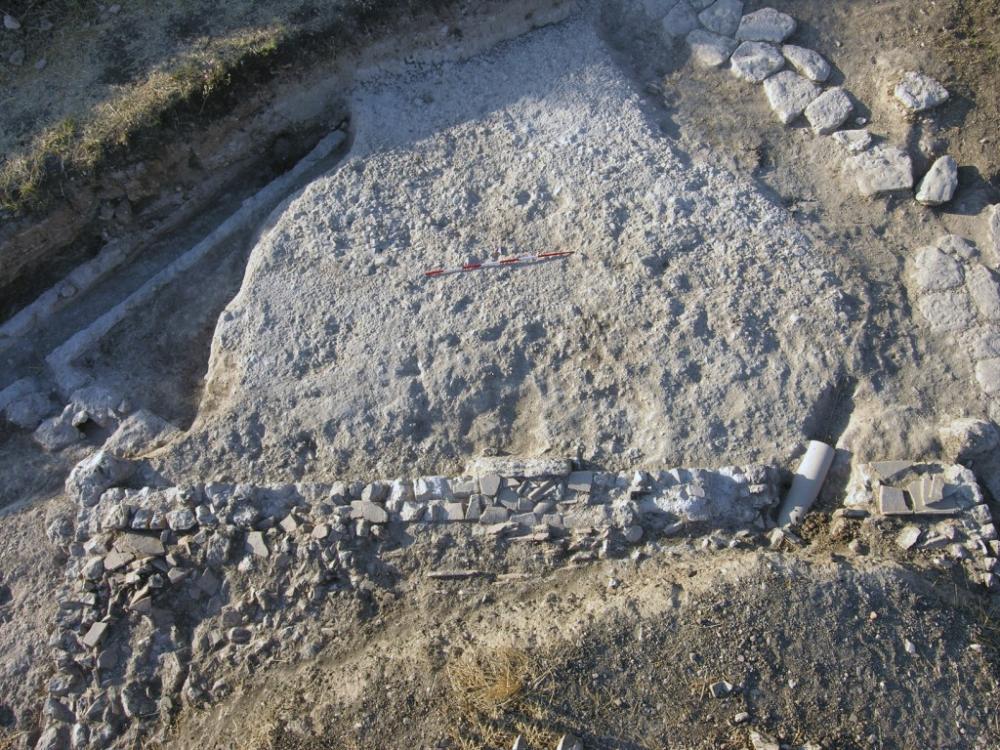
This sector constitutes an extension to the archaeological area and was necessary to protect and investigate the structures that emerged during work to modernise the sewer system adjacent to the area. In fact, in 2014 another stretch of road surface belonging to the Nomentum-Eretum road and a well-made sewer system built of tufa were identified. The latter was obliterated by a large abandonment layer rich in pottery and other materials. Most of the materials were of everyday domestic use, dating to between the 1st century B.C. and the 5th century A.D., with a predominance of African productions, from the 3rd century A.D. onwards. The walls of a presumed room remain to be investigated.
- Tiziana Sgrulloni- Archeoclub d'Italia sede Mentana-Monterotondo
- Sara Paoli- Archeoclub d'Italia sede Mentana-Monterotondo
Director
- Tiziana Sgrulloni- Archeoclub d'Italia sede Mentana-Monterotondo
Team
- Walter Benedetto Pantano
- Marco Zanardi
- Mary De Paolis
- Noemi Giovino
- Sara Paoli- Archeoclub d'Italia sede Mentana-Monterotondo
Research Body
- Archeoclub d'Italia sede Mentana-Monterotondo
Funding Body
- Archeoclub d'Italia sede Mentana-Monterotondo
![[PDF]](download.php?file=5838.jpg "Download")
![[PDF]](download.php?file=5839.jpg "Download")
![[PDF]](download.php?file=5840.jpg "Download")