


Summary (English)
The 2018 excavations concentrated on two main areas.
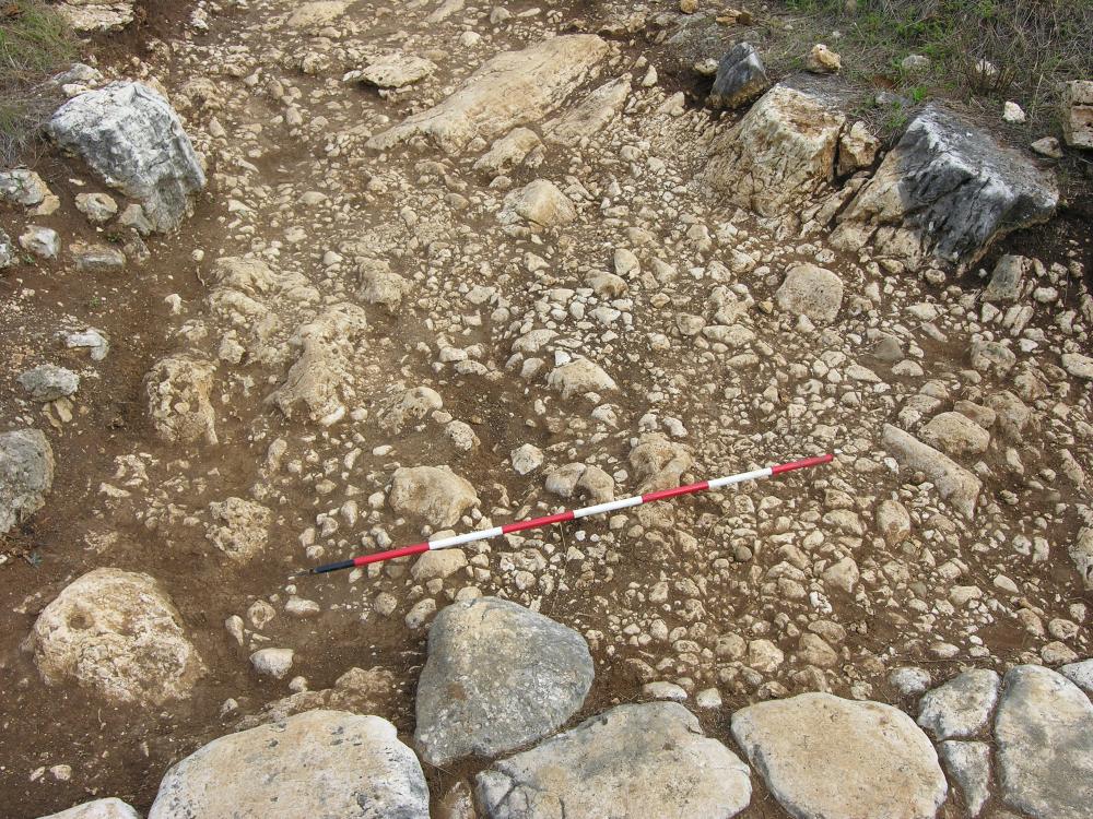
The Via glareata. The main element in the archaeological area is constituted by the continuation of the via Nomantana, which after reaching Nomentum continued north to rejoin the via Salaria at Eretum. A length of c. 140 m of this stretch, entirely paved in limestone basoli, has been exposed, which is flanked on both sides by a cemetery datable to between the 1st and 3rd centuries A.D. As the main function of this road was to serve the numerous rural villas that must have characterised the countryside of Nomentum, the presence of a side road (_via_ glareata) is not surprising, which from the main road must have led to a Roman cistern situated east of the area. To date, 15m of the side road have been excavated and it is formed by a beaten surface of small stones (limestone) mixed with clayey soil. Present among the stones were small basalt wedges, while stones of larger size were scattered across the entire road surface. The ceramic materials present date to between the late 2nd-1st century B.C. and the mid 4th century A.D.
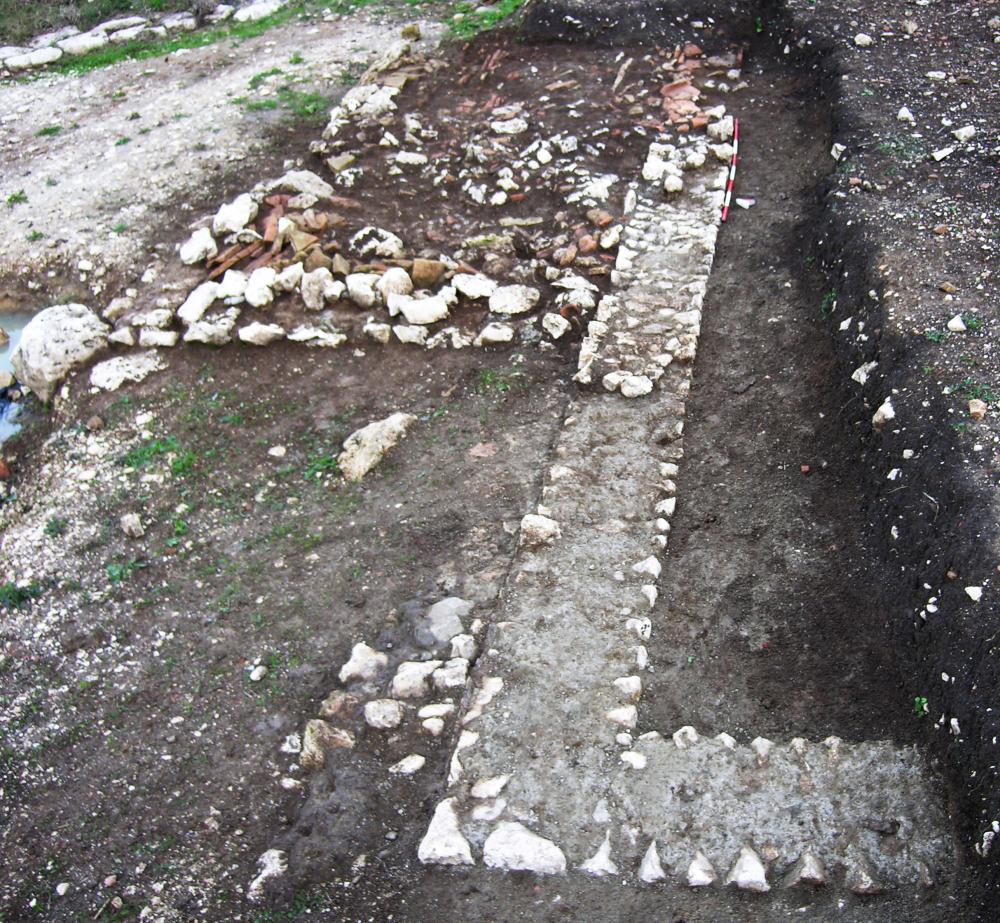
2. The “Pietrara” sector. This sector is an extension to the archaeological area that was necessary to safeguard and investigate the structures that emerged during work on the sewer system of an apartment block adjacent to the archaeological area itself. This season, the area was extended further and new walls uncovered that showed the situation to be more complicated than previously thought. It was confirmed that the investigated area was characterised by the presence of a substantial abandonment layer with a light brown clayey-silt matrix present across the entire sector. The large amount of pottery present dates this phase to between the late 4th and the early 5th centuries A.D. Two rooms were identified relating to two different construction phases. Firstly, two walls forming a right angle with a facing of limestone opus incertum and white plaster, partially preserved. Later, in a period that remains to be dated, the building was extended to the north with the addition of a structure built of limestone opus incertum. The area delimited by the latter was filled by several layers of collapse, as yet to be excavated.
- Tiziana Sgrulloni, Archeoclub d'Italia sede Mentana-Monterotondo
- Sara Paoli, Archeoclub d'Italia sede Mentana-Monterotondo
Director
- Tiziana Sgrulloni, Archeoclub d'Italia sede Mentana-Monterotondo
Team
- Walter Benedetto Pantano
- Marco Zanardi
- Mary De Paolis
- Roberto Civetta
- Sara Paoli, Archeoclub d'Italia sede Mentana-Monterotondo
- Tiziana Sgrulloni, Archeoclub d'Italia sede Mentana-Monterotondo
Research Body
- Archeoclub d'Italia sede Mentana-Monterotondo
Funding Body
- Archeoclub d'Italia sede Mentana-Monterotondo
![[PDF]](download.php?file=7484.jpg "Download")
![[PDF]](download.php?file=7486.jpg "Download")