


Summary (English)
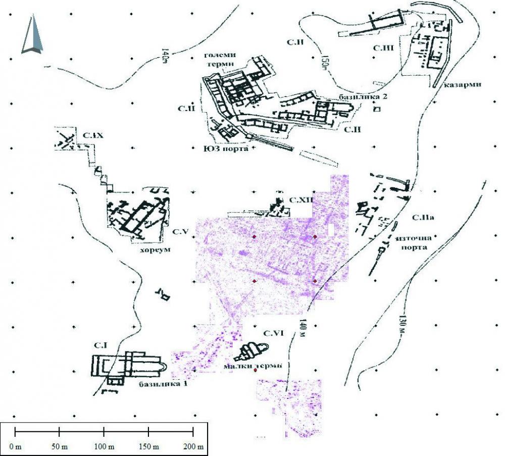
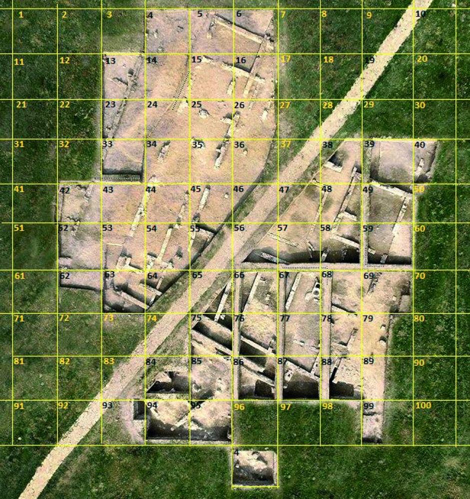
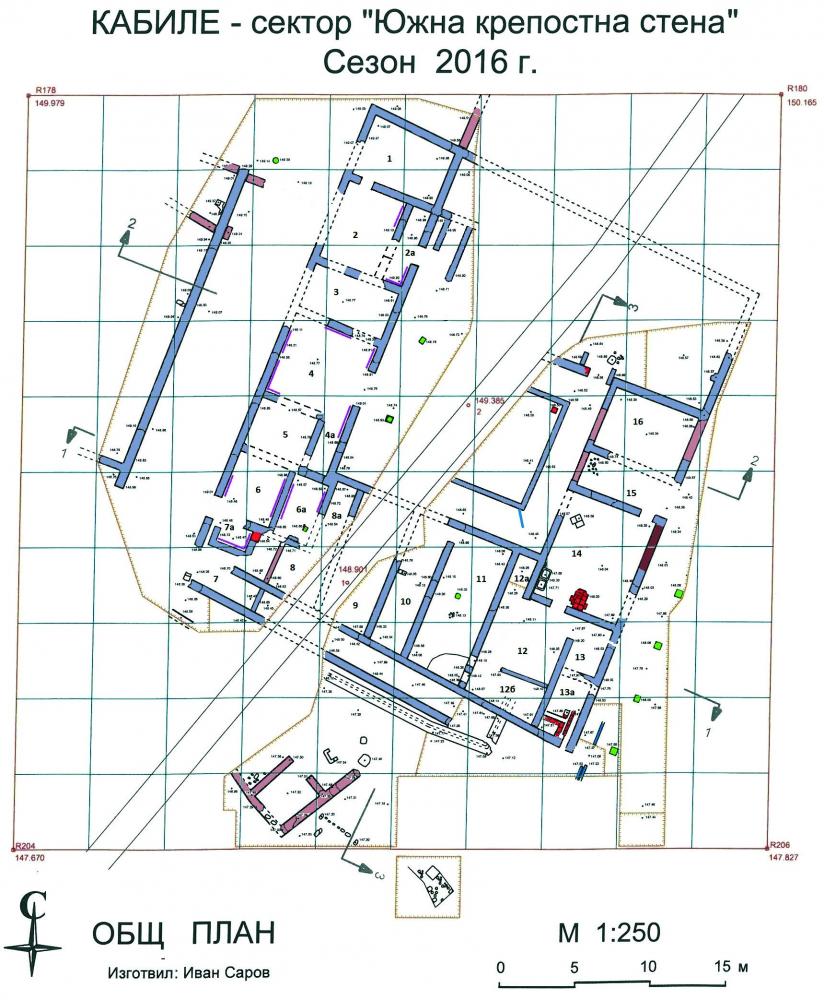
KABYLE (Stefan Bakardzhiev – st_bakarjiev@abv.bg) In quarters LX and LI, a layer of mortar debris from the fortification wall was explored, situated over a building constructed in rubble masonry and dated to the mid 3rd century BC. The coins of Probus and Numerian that were found, indicated that the fortification wall was built during the AD 280s. It was destroyed probably at the end of the 4th century AD. Building D, 34.10 m by 28.70 m in size, was explored at 8 m to the northeast of the fortification wall. The western, southern and part of the eastern wings were discovered with 16 rooms in total. The rooms were situated around an atrium 14.80 m by 12 m in size, with impluvium that measured 8 m by 8 m and had a water-conduit to take out the water. The impluvium was surrounded with porticos 2 m wide from the north, east and south, while the portico from the west was 4.75 m wide and had a colonnade with two timber pillars. A base of a column of the first half of the 2nd century AD was reused in the colonnade. The house was single-storey. The walls were 55 cm wide, built of stones bonded with mortar up to 50 – 60 cm in height, while the upper parts of the walls were constructed of sun-dried bricks. The roof was covered with tiles. The main entrance was on the eastern wall and there was a portico along the eastern side. Official rooms 3, 4, 5 and 6 were situated in the western wing and their inner walls were plastered with mortar. The building was reconstructed at least twice and had two occupation periods. The first one dated from the end of the 3rd century AD to AD 377 – 378, dated by coins from Diocletian to Julian found under the collapsed roof. The second period was dated by coins of Theodosius II and Justinian I and other finds of the 5th – 6th centuries AD. Two streets were explored along the eastern and the western sides of the building. The western street was 6 m wide and the eastern one was 12 m wide. The streets were paved with a layer 25 – 35 cm thick, consisting of small stones, rubble and sherds. A terracotta water-conduit was discovered beneath the eastern street.
- Stefan Bakardzhiev - Museum of History - Yambol
Director
Team
Research Body
- Museum of History - Yambol
![[PDF]](download.php?file=8824.jpg "Download")
![[PDF]](download.php?file=8825.jpg "Download")
![[PDF]](download.php?file=8826.jpg "Download")