


Summary (English)
Work on the Žumberak castle in 2005 included the archaeological excavation of the southern wall. The Žumberak castle was built towards the end of the 12th century and is located deep in the Žumberak hills, at a height of 500 m. In 1265, in the documents of Duke of Spanheim, the name of Engelbert of Žumberak (de Sicherberg in Carinthia) is mentioned, the founder of the Žumberak line of nobles from Kostanjevica. From the beginning of the 14th century, the Žumberak castle was no longer ruled by Žumberak nobility and the rights were granted to various other families. Thus, during the 14th century, the castle was managed by the Babonić family and Duke Henry Goričko-Tirolski. In the 15th century, the Žumberak family took over the castle again, but by the end of the century they became so impoverished that the Emperor Maximilian I gave the castle and its estate to the Bishop of Ljubljana Krištof Rauber at the beginning of the 16th century, and then in 1505 to Nikola Semenič. In 1543 it came into the possession of Janez Pichler, who began settling the Uskoks there. Their settlement meant the end of the Žumberak lordship. The castle had been abandoned because it was no longer strategically suitable for defence, and a new fort was built, the seat of the Žumberak captains.
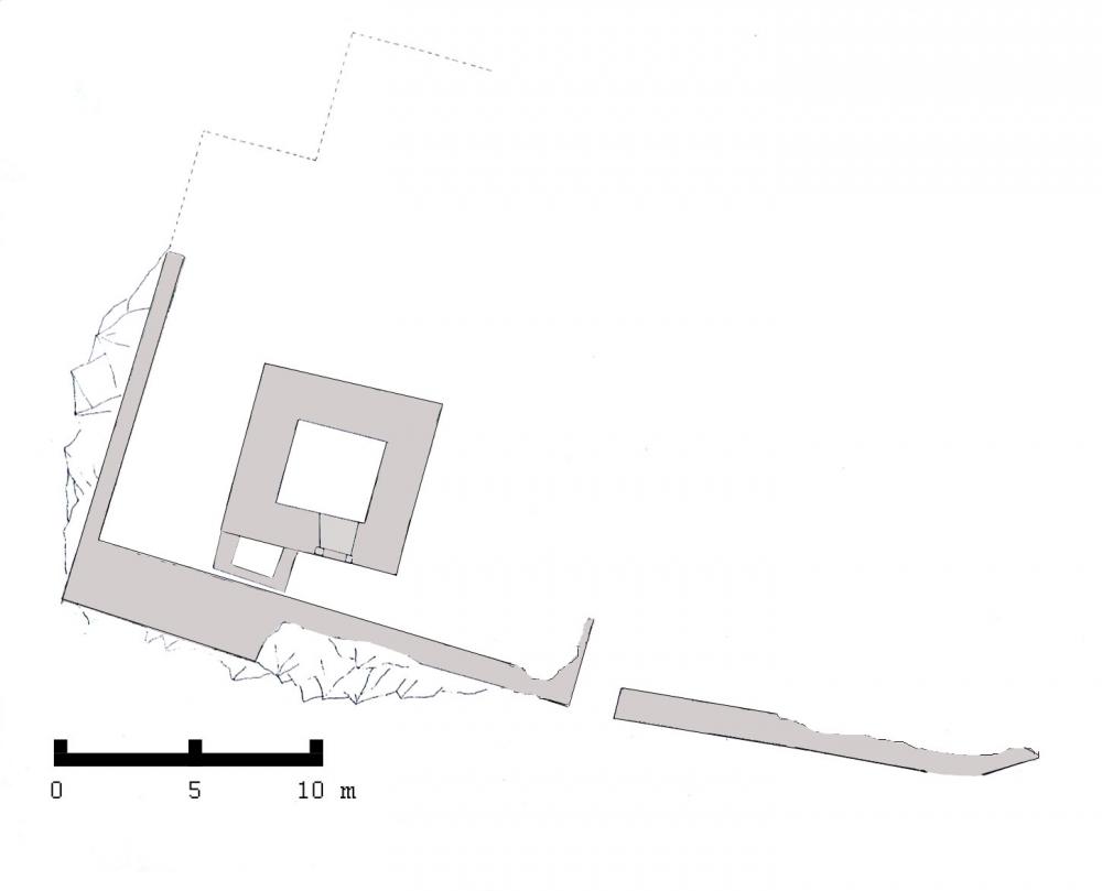
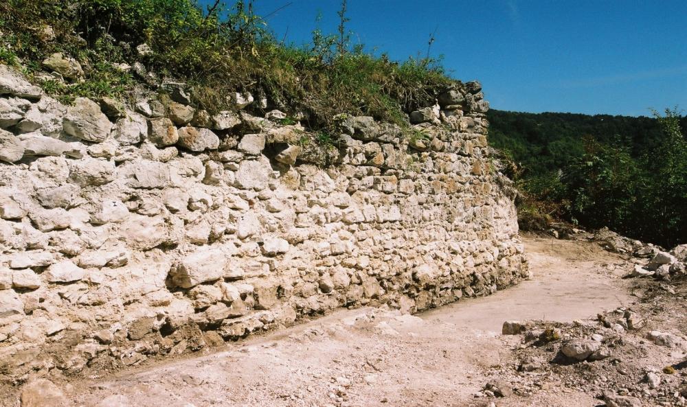
In 1296, next to the castle, papal fiscal archives mention the parish of St. Cross Žumberak. To the west of the castle, a relatively large church was found, which confirms the allegations from the papal documents. The castle was built on a 500 m high hill, where the two valleys of the river Kupčina meet. It consists of a plateau surrounded by an ellipsoidal moat, a defensive tower, a defensive wall and a church built outside of the walls. The southern slope of the plateau was lined with a solid stone wall. It is a typical Romanesque fort, considering the way it was built and its layout.
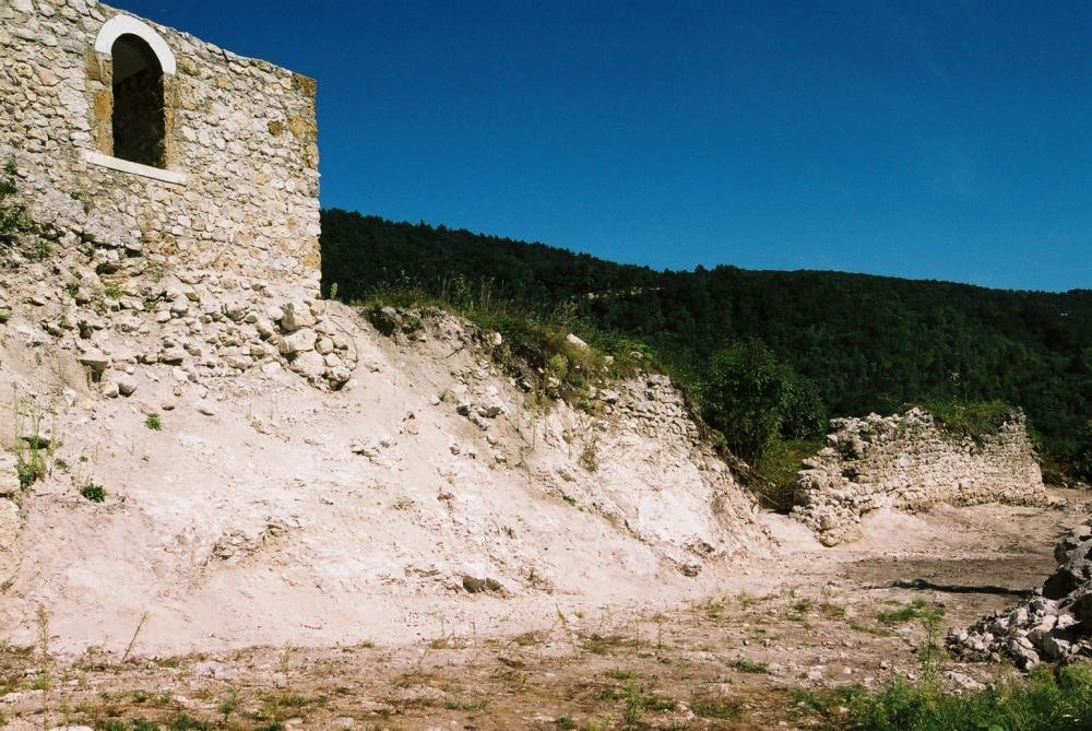
Archaeological and conservation work began in 1988 and so far the church, the defensive tower and the southern part of the defensive rampart with the main entrance door have been excavated. Conservation work was carried out on the foundations of the church and the tower. The tower was partially reconstructed to the height of the first floor with the reconstruction of the entrance door. Archaeological finds excavated in the tower consist of ceramic and metal artefacts.
Works in 2005, which included the archaeological excavations of the southern city wall, revealed the main entrance to the castle. They are located east of the tower and lead into a spacious courtyard (D. Lapajne 2006, Hrvatski arheološki godišnjak 2/2005, 157–158).
- Damjan Lapajne
Director
- Damjan Lapajne
Team
- Tatjana Lolić
Research Body
- Ministarstvo kulture Republike Hrvatske
Funding Body
- Ministarstvo kulture Republike Hrvatske
![[PDF]](download.php?file=11686.jpg "Download")
![[PDF]](download.php?file=11687.jpeg "Download")
![[PDF]](download.php?file=11688.jpeg "Download")