Summary (English)
The archaeological site Taor is located at the eastern periphery of the village bearing the same name, 20 km SE from Skopje. The fortified Late Antiquity settlement is positioned on a dominant hill, overlooking the Vardar River and the Skopje Valley. Archaeological investigations are regularly carried out since 2000.
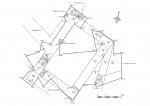
The 2017 campaign was focused on the southernmost point of the fortification system, where the eastern and the western wall meet into a frontal defensive tower. The local population in the past have completely removed the walls of the tower, leaving behind only negatives from the wall foundations and some rubble. Therefore, the plan of the tower was established only through detailed and careful excavation and documentation of the negatives into the yellow clay.
The tower has a rectangular plan, measuring 8.7×6.3 m, with 1 m wide walls. With its northern wall it is fully integrated, and therefore built at the same time with the eastern and the western fortification walls. According to the small number of artefacts discovered here (pottery, coins, metal objects etc.), the tower and the fortification were built in the 6th century.
- Darko Stojanovski


![Download [PDF]](/excavation/skins/fasti/images/results/download_sml.png)
