


Summary (English)
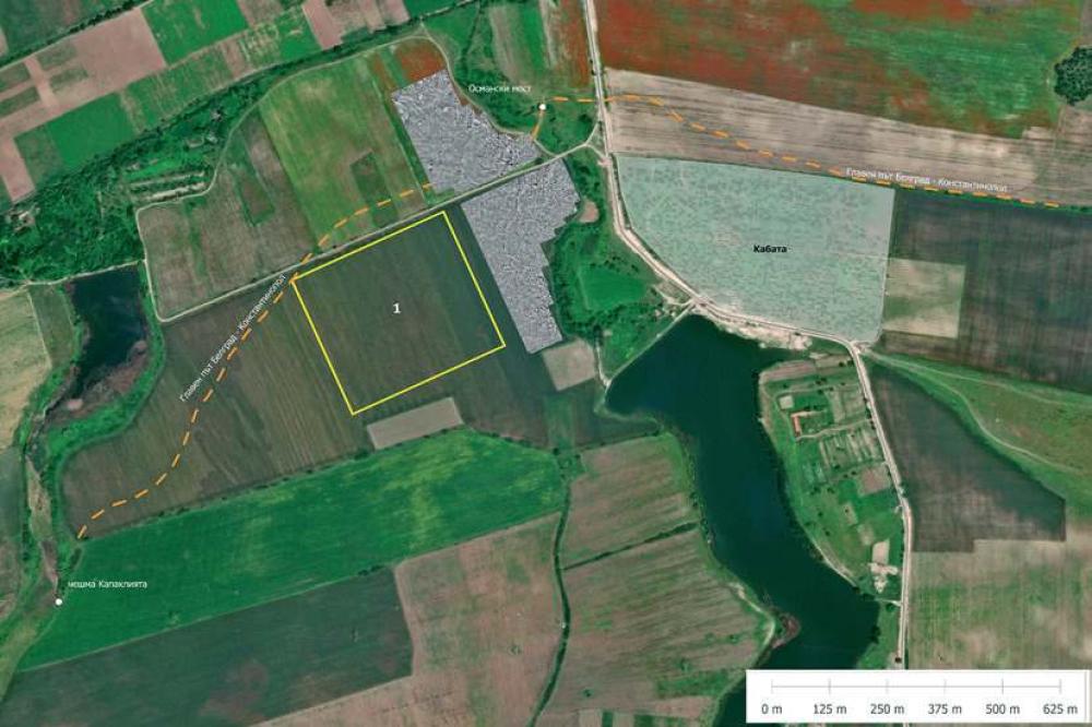
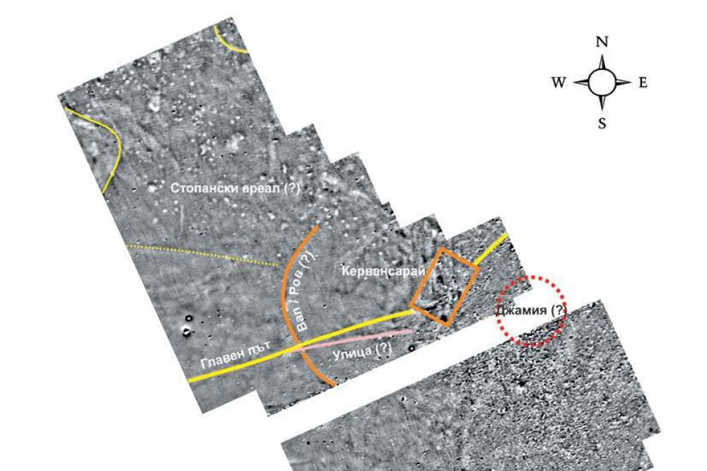
EXPLORATIONS NEAR THE VILLAGE OF KONUSH (Chavdar Kirilov – kirilovarch@gmail.com) Geomagnetic exploration and field survey with collecting archaeological material were carried out on an area of 43,625 sq. m. The finds included sherds and fragmentary building ceramics of the Ottoman period, flints from flint-studded threshing-boards, broken glass from windows, iron slag and objects, glass melts and bracelets. The geophysical measurement identified a wide strip that was a section of the main road from Belgrade to Constantinople directed towards the Ottoman bridge on Konushka River. The main road ran along a large geomagnetic anomaly, at least 0.2 ha in size, situated to the south; probably, it was the caravanserai described in Ottoman and West European written sources. Monumental walls and decorated marble architectural fragments were also documented from the southern side of the main road. Probably, they belonged to the destroyed mosque that was situated nearby. An area without geomagnetic anomalies was documented to the west of the monumental buildings; its western side was surrounded with a semicircle (a rampart, or a ditch) over 100 m in diameter.
- Chavdar Kirilov - Department of Archaeology, Sofia University St. Kliment Ohridski
Director
- Chavdar Kirilov - Department of Archaeology, Sofia University St. Kliment Ohridski
Team
Research Body
- Sofia University St. Kliment Ohridski
![[PDF]](download.php?file=15321.jpg "Download")
![[PDF]](download.php?file=15322.jpg "Download")