Summary (English)
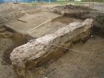
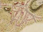
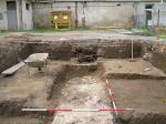
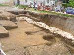
During the excavation of the foundations of the new building for the Cadastre Department, on May 18, 2006, part of the stone structure was discovered at cadastral plot 2122, cadastral municipality of Požega. Cadastral plot 2122 is located within the protected urban zone of the city of Požega. Accordingly, before the start of further construction works, it was necessary to carry out rescue archaeological excavation. The excavation followed immediately after the discovery of the stone structure and lasted from May 18 to June 3, 2006. The excavation area was limited only to the area of the foundations of the future building. During the excavation, it was established that the architecture discovered represents part of the foundation of the medieval wall. Within the excavation area, measuring 10 × 20 m, the foundation of the wall was preserved in a length of 16.20 m. The foundation was built of crushed stone filled with quicklime, and in addition to the foundation, the bottom of the wall structure has also been preserved in places. The width of the foundation is 1.2 m, and the width of the partially preserved wall is 0.80 m. The dimensions of the foundation, the material and the building technique, as well as the width of the preserved part of the wall, support the assumption that the stone structure represents part of a building of unknown purpose and unknown dimensions. As the foundation is poorly structured, too narrow and made of too fine material, it is not possible to talk about its defensive purpose. According to the known data about the area of the historic city core, it is possible to claim that the defensive rampart of Požega was located a little further west and that the preserved foundation represents a residential or another type of structure within the city area. Despite expectations, it was not possible to determine the cultural layers within the excavation area. The entire surface of the courtyard was recently rebuilt, so most of the layers that contained material were mixed with recent material and it was impossible to determine any stratigraphy within the excavation area. Based on the found material, we can only tentatively date the building to which the wall belonged. Most of the material was found mixed with recent material and within recent layers, and it is roughly dated between the 12th and 16th centuries. After the excavation, the foundation of the wall was completely covered with geotextile and filled with sand (Kristina Vodička 2007, Hrvatski arheološki godišnjak 3/2006, 89–91).
- Kristina Vodička
Director
Team
Research Body
- Geoarheo d.o.o.
- Konzervatorski odjel u Požegi
Funding Body
- Državna geodetska uprava


![Download [PDF]](/excavation/skins/fasti/images/results/download_sml.png)


