


Summary (English)
Research (2006-2013)
The archaeological site of Los Rodiles is highly representative of Celtiberian villages that grew from the beginning of the 3rd century and became the center of little geographic regions. These settlements acquired a certain degree of autonomy although they were closely tied to a larger center, which could have been Arcóbriga, Bílbilis o Segeda in this case.
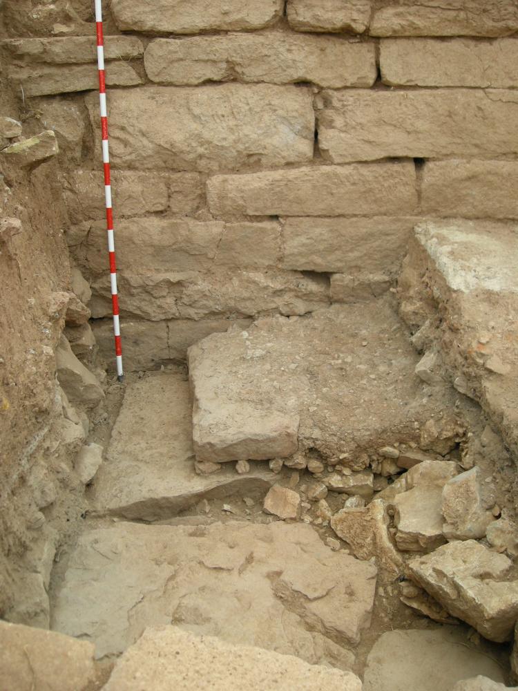
One of the most interesting aspects is the existence of two levels of occupation (Rodiles I and Rodiles II phases), separated by a level destroyed by fire, clearly visible due to abundant coal and ashes. All this is almost certainly a sign of the incidents that occurred there as a consequence of the Gracchan incursions in 179 BC or Nobilor’s campaign against Segeda, in 154-153 BC.
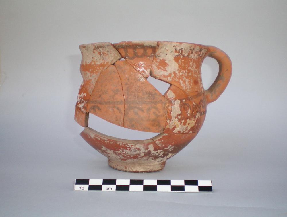
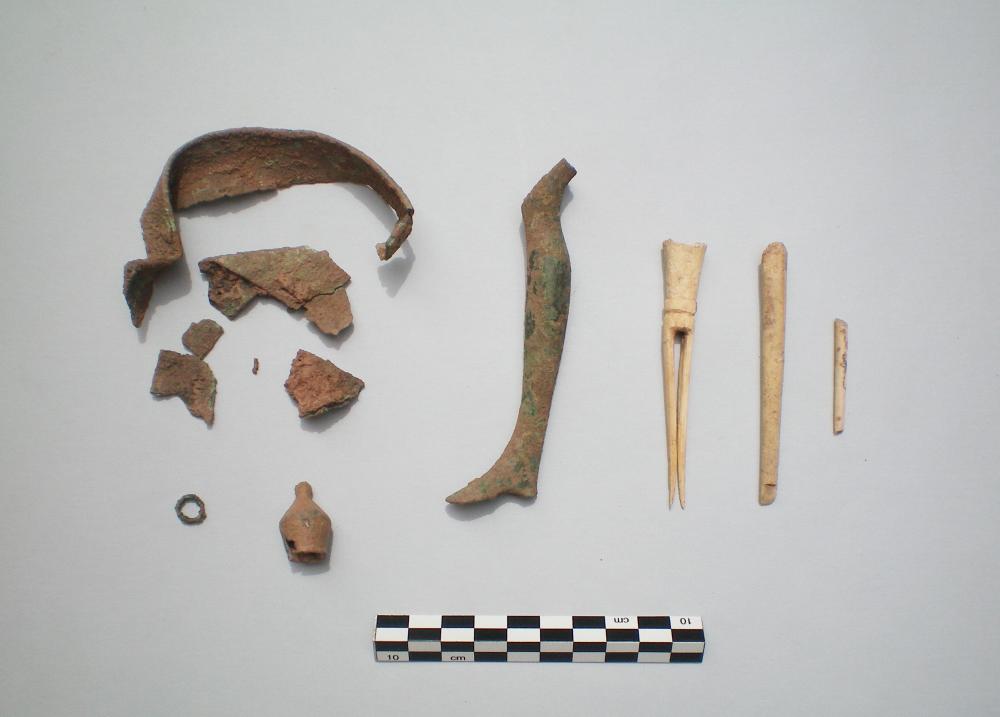
Data obtained reveal the dynamic development of the Celtiberian plateau society during the 3rd century, both through dwelling and defensive structures, as well as pottery. They also confirm that the indigenous communities continued with an even more powerful development after the fire, produced by armed clashes, although this time under Roman rule. The latter detail is revealed by the fact that numerous imported Roman materials, among which black-glazed pottery, Italic amphorae, some bone objects, a shield boss or umbo, and several bronze asses from the mints of Titiakos, Tamaniu, Ekualakos and Castulo were found, together with high quality, elaborately decorated Celtiberian ware.
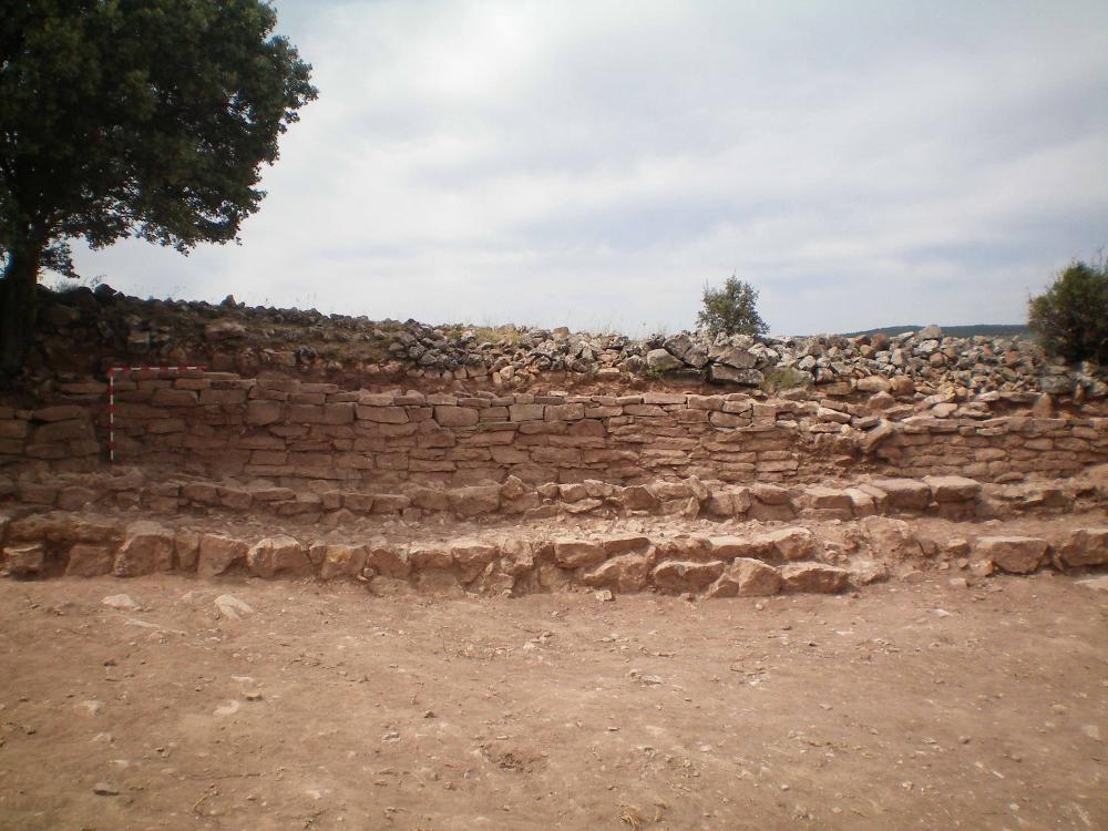
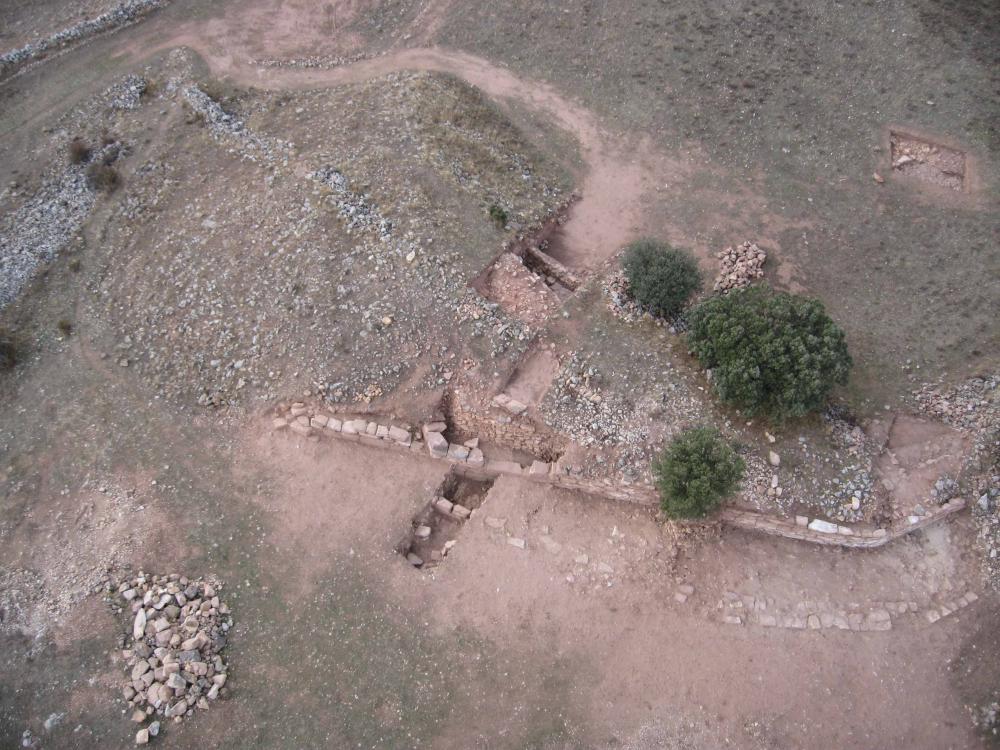
In 2005 intensive visual survey of the site and its immediate surroundings was undertaken. It confirmed its high archeological interest. In 2006 systematic works started. A comprehensive assessment campaign was conducted by means of aerial photography, georeferencing of the site, a first geophysical survey and stratigraphic sondages. In 2007 the first programmed excavation season took place. The site has a total area of 5 hectares, within which up to three concentric walled enclosures have been identified.
(translation by Laura González Fernández)
- M.ª Luisa Cerdeño, Emilio Gamo y Marta Chordá
Director
- Maria Luisa Cerdeño y Emilio Gamo (U. C. M.-Departamento de Prehistoria), Marta Chordá (Centro de Estudios Celtibéricos de Segeda)
Team
Research Body
- Universidad Complutense de Madrid
Funding Body
- Junta de Comunidades de Castilla-La Mancha
![[PDF]](download.php?file=1144.jpg "Download")
![[PDF]](download.php?file=1145.jpg "Download")
![[PDF]](download.php?file=1149.jpg "Download")
![[PDF]](download.php?file=1147.jpg "Download")
![[PDF]](download.php?file=1148.jpg "Download")