Summary (English)
The 2015 excavations in the Archaeological and Nature Park of Santa Maria di Agnano concentrated on the stratigraphic analysis of the three investigated areas.
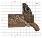
The first zone was an area situated close to the western rock face, continuing the trench excavated in 2010-2011. The excavation of areas H-I-P-Q was extended with the aim of identifying the foundation of the limestone boulders forming the archaic-Classical peribolos and intercepting levels that were not disturbed by the continual man-made modifications to the site. The archaeological stratigraphy in the south zone comprised various levels of agricultural soil and archaeological deposits dating to the Neolithic period. The Neolithic occupation surface presented hearths attested by various sized spreads of charcoal residue of difficult attribution. There was also a large hearth (Hearth1/Pit-Hearth1 bis) with a baked clay surface abutting the steep rock face delimiting the trench to the west. Nearby, Hearth 2 did not have a combustion structure of baked clay like the first, but was formed by a first level comprising a few fragments of Neolithic pottery and a base surface with outcrops of Pleistocene fauna and Epipalaeolithic-Mesolithic lithic industry.
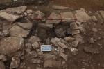
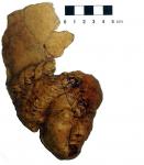
A small walled structured with a clear ritual function (Ritual Area 1) was situated up against the north side of the peribolos. It was lined with limestone slabs and flattened blocks and had two limestone altars preserved in situ. Among the finds supporting the dating to between the 4th and 3rd centuries B.C. were a terracotta protome with flowing hair and tall cap, a female divinity, probably Demeter, wearing a pòlos, and a miniature amphora. Another ritual area (Ritual Area 2) was identified to the east of Ritual Area 1. It was delimited by a semi-circular wall of limestone blocks. The finds included a fragmented hydria painted with narrow red bands and decorated on the external surface of the vertical strap handle with the symbol of a “four-branched torch”, usually attributed to the cult of Demeter, and an iron lanceolate spearhead placed vertically and datable to the 4th century B.C.
Further excavation took place on the lower terrace in front of the grotto (area M and L). In the southern extension of area M, large stones were uncovered situated at a higher level than the collapse investigated in 2011, from which they were separated by a layer of earth. This suggests the collapse occurred in two phases. A large quadrangular block with mouldings on the two visible sides, and a hole for the insertion of a cramp, which probably belonged to a large building, emerged from the south-western wall of area L. The excavation of the north-eastern corner of the area revealed a layer of friable yellow earth. This was crumbled local stone, called “tufina”, and could represent a surface whose alignment and size remain to be investigated. This season’s excavations showed the collapse to be more extensive, in particular area M towards the south and east. Towards the north, the collapse seemed to follow the line of a marked slope.
- Donato Coppola – Università degli Studi di Bari “Aldo Moro”
- Michele Pellegrino - Università degli Studi di Bari “Aldo Moro”
- Nicola de Pinto - Università degli Studi di Bari “Aldo Moro”
Director
- Donato Coppola – Università degli Studi di Bari “Aldo Moro”
Team
- Henry Baills - Musée de Tautavel, Centre Européen de Préhistoire
- Nicola de Pinto - Università degli Studi di Bari “Aldo Moro”
- Martine Dewailly - Ecole Française de Rome
- Michele Pellegrino - Università degli Studi di Bari “Aldo Moro”
Research Body
- Università degli Studi di Bari “Aldo Moro”
Funding Body
- Comune di Ostuni
- Museo di Civiltà Preclassiche della Murgia meridionale


![Download [PDF]](/excavation/skins/fasti/images/results/download_sml.png)


